
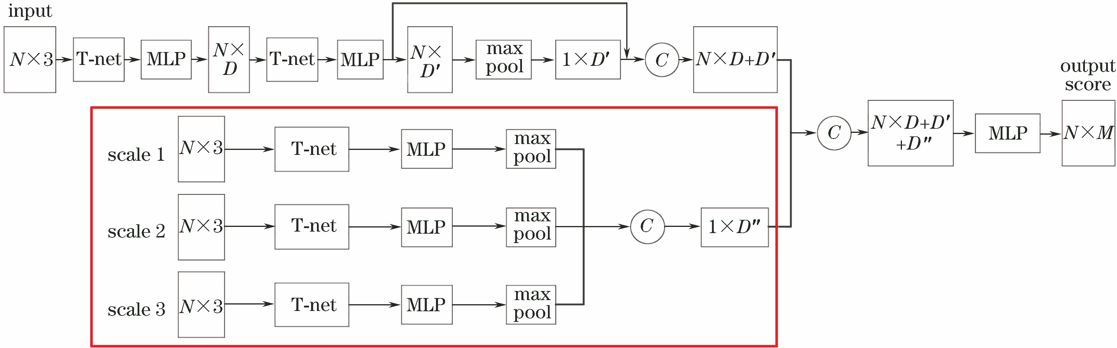
Zhongyang Zhao, Yinglei Cheng, Xiaosong Shi, Xianxiang Qin, Xin Li. Terrain Classification of LiDAR Point Cloud Based on Multi-Scale Features and PointNet[J]. Laser & Optoelectronics Progress, 2019, 56(5): 052804
- Laser & Optoelectronics Progress
- Vol. 56, Issue 5, 052804 (2019)
Abstract

Set citation alerts for the article
Please enter your email address
© Copyright 2018-2021 | Chinese Laser Press. All Rights Reserved 沪ICP备15018463号-20