[1] Turner B L, Meyer W B, Skole D L. Global land-use/land-cover change: Towards an integrated study[J]. Ambio, 23, 91-95(1994).
[2] Klein Goldewijk K. Estimating global land use change over the past 300 years: The HYDE Database[J]. Global Biogeochemical Cycles, 15, 417-433(2001).
[3] GeQuansheng, DaiJunhu, HeFanneng, et al. Research on land use and land cover change and carbon cycle of China during the past 300 years. Science in China Series D: Earth Science, 2008,38(2):197-210. [ 葛全胜, 戴君虎, 何凡能, 等. 过去300年中国土地利用、土地覆被变化与碳循环研究. 中国科学D辑: 地球科学, 2008,38(2):197-210.] [葛全胜, 戴君虎, 何凡能, 等. 过去300年中国土地利用、土地覆被变化与碳循环研究. 中国科学D辑: 地球科学, 2008, 38(2): 197-210.]
[4] BaiShuying, ZhangShuwen, ZhangYangzhen. Digital rebuilding of LUCC spatial-temporal distribution of the last 100 years: Taking Dorbod Mongolian Autonomous County in Daqing City as an example. Acta Geographica Sinica, 2007,62(4):427-436. [ 白淑英, 张树文, 张养贞. 土地利用/土地覆被时空分布100年数字重建: 以大庆市杜尔伯特蒙古族自治县为例. 地理学报, 2007,62(4):427-436.] [白淑英, 张树文, 张养贞. 土地利用/土地覆被时空分布100年数字重建: 以大庆市杜尔伯特蒙古族自治县为例. 地理学报, 2007, 62(4): 427-436.]
[5] ZhuFeng, CuiXuefeng, MiaoLijuan. China's spatially-explicit historical land-use data and its reconstruction methodology. Progress in Geography, 2012,31(12):1563-1573. [ 朱枫, 崔雪锋, 缪丽娟. 中国历史时期土地利用数据集的重建方法述评. 地理科学进展, 2012,31(12):1563-1573.] [朱枫, 崔雪锋, 缪丽娟. 中国历史时期土地利用数据集的重建方法述评. 地理科学进展, 2012, 31(12): 1563-1573.]
[6] LiJiayang, ChenPanqin, MaZhuguo, et al. Regional research: A main approach to understanding the global environmental change. Advances in Earth Science, 2006,21(5):441-450. [ 李家洋, 陈泮勤, 马柱国, 等. 区域研究: 全球变化研究的重要途径. 地球科学进展, 2006,21(5):441-450.] [李家洋, 陈泮勤, 马柱国, 等. 区域研究: 全球变化研究的重要途径. 地球科学进展, 2006, 21(5): 441-450.]
[7] CaiYunlong. A study on land use/cover change: The need for a new integrated approach. Geographical Research, 2001,20(6):645-652. [ 蔡运龙. 土地利用/土地覆被变化研究: 寻求新的综合途径. 地理研究, 2001,20(6):645-652.] [蔡运龙. 土地利用/土地覆被变化研究: 寻求新的综合途径. 地理研究, 2001, 20(6): 645-652.]
[8] Lambin E F, Baulies X, Bockstael N et al. Land-use and land cover change (LUCC): Implementation strategy. IGBP Report No.48 / IHDP Report No.10[J]. Stockholm: IGBP(1999).
[9] Becker A, Bugmann H. Global change and mountain regions: The mountain research initiative[J]. Stockholm: IGBP(2001).
[10] Ramankutty N, Foley J A. Estimating historical changes in global land cover: Croplands from 1700 to 1992[J]. Global Biogeochemical Cycles, 13, 997-1027(1999).
[11] Klein Goldewijk K, Beusen A, Doelman J et al. Anthropogenic land use estimates for the Holocene- HYDE 3.2[J]. Earth System Science Data, 9, 927-953(2017).
[12] Pongratz J, Reick C, Raddatz T et al. A reconstruction of global agricultural areas and land cover for the last millennium[J]. Global Biogeochemical Cycles, 22, 1-16(2008).
[13] Kaplan J O, Krumhardt K M, Ellis E C et al. Holocene carbon emissions as a result of anthropogenic land cover change[J]. The Holocene, 21, 775-791(2011).
[14] LiBeibei, FangXiuqi, YeYu, et al. Accuracy assessment of global historical cropland datasets based on regional reconstructed historical data: A case study in Northeast China. Science China Earth Sciences, 2010,40(8):1048-1059. [ 李蓓蓓, 方修琦, 叶瑜, 等. 全球土地利用数据集精度的区域评估: 以中国东北地区为例. 中国科学: 地球科学, 2010,40(8):1048-1059.] [李蓓蓓, 方修琦, 叶瑜, 等. 全球土地利用数据集精度的区域评估: 以中国东北地区为例. 中国科学: 地球科学, 2010, 40(8): 1048-1059.]
[15] HeFanneng, LiShicheng, ZhangXuezhen, et al. Comparisons of reconstructed cropland area from multiple datasets for the traditional cultivated region of China in the last 300 years. Acta Geographica Sinica, 2012,67(9):1190-1200. [ 何凡能, 李士成, 张学珍, 等. 中国传统农区过去300年耕地重建结果的对比分析. 地理学报, 2012,67(9):1190-1200.] [何凡能, 李士成, 张学珍, 等. 中国传统农区过去300年耕地重建结果的对比分析. 地理学报, 2012, 67(9): 1190-1200.]
[16] Zhang Xuezhen, He Fanneng, Li Shicheng. Reconstructed cropland in the mid-eleventh century in the traditional agricultural area of China: Implications of comparisons among datasets[J]. Regional Environmental Change, 13, 969-977(2013).
[17] HeFanneng, LiShicheng, YangFan, et al. Evaluating the accuracy of Chinese pasture data in global historical land use datasets. Science China Earth Sciences, 2019,49(2):421-433. [ 何凡能, 李士成, 杨帆, 等. 全球历史土地利用数据集中国草地数据可靠性评估. 中国科学: 地球科学, 2019,49(2):421-433.] [何凡能, 李士成, 杨帆, 等. 全球历史土地利用数据集中国草地数据可靠性评估. 中国科学: 地球科学, 2019, 49(2): 421-433.]
[18] YangFan, HeFanneng, LiMeijiao, et al. Reliability assessment of global historical forest data in China. Acta Geographica Sinica, 2019,74(5):923-934. [ 杨帆, 何凡能, 李美娇, 等. 全球历史森林数据中国区域的可靠性评估. 地理学报, 2019,74(5):923-934.] [杨帆, 何凡能, 李美娇, 等. 全球历史森林数据中国区域的可靠性评估. 地理学报, 2019, 74(5): 923-934.]
[19] Yang Fan, He Fanneng, Li Shicheng et al. Exploring spatiotemporal pattern of grassland cover in Western China from 1661 to 1996[J]. International Journal of Environmental Research and Public Health, 16, 1-18(2019).
[20] HeFanneng, LiMeijiao, YangFan. Main progress in historical land use and land cover change in China during the past 70 years. Journal of Chinese Historical Geography, 2019,34(4):5-16. [ 何凡能, 李美娇, 杨帆. 近70年中国历史时期土地利用/覆被变化研究的主要进展. 中国历史地理论丛, 2019,34(4):5-16.] [何凡能, 李美娇, 杨帆. 近70年中国历史时期土地利用/覆被变化研究的主要进展. 中国历史地理论丛, 2019, 34(4): 5-16.]
[21] LinShanshan, ZhengJingyun, HeFanneng. The approach for gridding data derived from historical cropland records of the traditional cultivated region in China. Acta Geographica Sinica, 2008,63(1):83-92. [ 林珊珊, 郑景云, 何凡能. 中国传统农区历史耕地数据网格化方法. 地理学报, 2008,63(1):83-92.] [林珊珊, 郑景云, 何凡能. 中国传统农区历史耕地数据网格化方法. 地理学报, 2008, 63(1): 83-92.]
[22] Liu Mingliang, Tian Hanqin. China's land cover and land use change from 1700 to 2005: Estimations from high-resolution satellite data and historical archives[J]. Global Biogeochemical Cycles, 24, 1-18(2010).
[23] HeFanneng, LiShicheng, ZhangXuezhen. The reconstruction of cropland area and its spatial distribution pattern in the mid-northern Song Dynasty. Acta Geographica Sinica, 2011,66(11):1531-1539. [ 何凡能, 李士成, 张学珍. 北宋中期耕地面积及其空间分布格局重建. 地理学报, 2011,66(11):1531-1539.] [何凡能, 李士成, 张学珍. 北宋中期耕地面积及其空间分布格局重建. 地理学报, 2011, 66(11): 1531-1539.]
[24] WeiXiwen, MiaoLijuan, JiangYuan, et al. Reconstruction of the historical crop land data in China using the partition and layering-based gridded method. Acta Geographica Sinica, 2016,71(7):1144-1156. [ 魏希文, 缪丽娟, 江源, 等, 基于分层分区法的中国历史耕地数据的网格化重建. 地理学报, 2016,71(7):1144-1156.] [魏希文, 缪丽娟, 江源, 等, 基于分层分区法的中国历史耕地数据的网格化重建. 地理学报, 2016, 71(7): 1144-1156.]
[25] JiangLanqi, ZhangLijuan, ZangShuying, et al. Comparison of approaches of spatially explicit reconstruction of cropland in the late Qing Dynasty. Acta Geographica Sinica, 2015,70(4):625-635.
[26] LiMeijiao, HeFanneng, YangFan, et al. Reconstruction of cropland area at the provincial level in the early Yuan Dynasty. Acta Geographica Sinica, 2018,73(5):832-842. [ 李美娇, 何凡能, 杨帆, 等. 元代前期省域耕地面积重建. 地理学报, 2018,73(5):832-842.] [李美娇, 何凡能, 杨帆, 等. 元代前期省域耕地面积重建. 地理学报, 2018, 73(5): 832-842.]
[27] LiKe, HeFanneng, ZhangXuezhen. An approach to reconstructing spatial distribution of historical cropland with grid-boxes by utilizing MODIS land cover dataset: A case study of Yunnan Province in the Qing Dynasty. Geographical Research, 2011,30(12):2281-2288. [ 李柯, 何凡能, 张学珍. 基于MODIS数据网格化重建历史耕地空间分布的方法: 以清代云南省为例. 地理研究, 2011,30(12):2281-2288.] [李柯, 何凡能, 张学珍. 基于MODIS数据网格化重建历史耕地空间分布的方法: 以清代云南省为例. 地理研究, 2011, 30(12): 2281-2288.]
[28] LiShicheng, HeFanneng, ChenYisong. Gridding reconstruction of cropland spatial patterns in Southwest China in the Qing Dynasty. Progress in Geography, 2012,31(9):1196-1203. [ 李士成, 何凡能, 陈屹松. 清代西南地区耕地空间格局网格化重建. 地理科学进展, 2012,31(9):1196-1203.] [李士成, 何凡能, 陈屹松. 清代西南地区耕地空间格局网格化重建. 地理科学进展, 2012, 31(9): 1196-1203.]
[29] PanQian, JinXiaobin, ZhouYinkang. Gridding reconstruction of land use pattern in Jiangsu Province in the mid-Qing Dynasty. Acta Geographica Sinica, 2015,70(9):1449-1462. [ 潘倩, 金晓斌, 周寅康. 清代中期江苏省土地利用格局网格化重建. 地理学报, 2015,70(9):1449-1462.] [潘倩, 金晓斌, 周寅康. 清代中期江苏省土地利用格局网格化重建. 地理学报, 2015, 70(9): 1449-1462.]
[30] Yang Xuhong, Jin Xiaobin, Guo Beibei et al. Research on reconstructing spatial distribution of historical cropland over 300 years in traditional cultivated regions of China[J]. Global and Planetary Change, 128, 90-102(2015).
[31] LvYan, ZhangShuwen, YangJiuchun. Application of toponymy to the historical LUCC researches in Northeast China: Taking Zhenlai County of Jilin Province as an example. Journal of Geo-information Science, 2010,12(2):174-179. [ 吕妍, 张树文, 杨久春. 基于地名志的东北历史时期土地利用变化研究: 以吉林省镇赉县为例. 地球信息科学学报, 2010,12(2):174-179.] [吕妍, 张树文, 杨久春. 基于地名志的东北历史时期土地利用变化研究: 以吉林省镇赉县为例. 地球信息科学学报, 2010, 12(2): 174-179.]
[32] ZengZaozao, FangXiuqi, YeYu. The process of land cultivation based on settlement names in Jilin Province in the past 300 years. Acta Geographica Sinica, 2011,66(7):985-993. [ 曾早早, 方修琦, 叶瑜. 基于聚落地名记录的过去300年吉林省土地开垦过程. 地理学报, 2011,66(7):985-993.] [曾早早, 方修琦, 叶瑜. 基于聚落地名记录的过去300年吉林省土地开垦过程. 地理学报, 2011, 66(7): 985-993.]
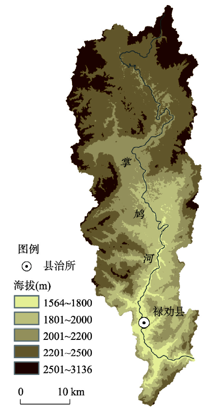
[33] HuoRenlong, YangYuda, ManZhimin. Pattern evolution of settlement space in the Zhangjiuhe Basin, Yunnan Province, during the past 300 years. Geographical Research, 2016,35(9):1647-1658. [ 霍仁龙, 杨煜达, 满志敏. 云南省掌鸠河流域近300年来聚落空间演变. 地理研究, 2016,35(9):1647-1658.] [霍仁龙, 杨煜达, 满志敏. 云南省掌鸠河流域近300年来聚落空间演变. 地理研究, 2016, 35(9): 1647-1658.]
[34] ZhaoJie, ZhaoShidong. Application of the participatory rural appraisal method in the research of land use change at local dimension: A case study of Yaoledianzi village in Korqin sand. Resources Science, 2003,25(5):52-57. [ 赵杰, 赵士洞. 参与性评估法在小尺度区域土地利用变化研究中的应用: 以科尔沁沙地尧勒甸子村为例. 资源科学, 2003,25(5):52-57.] [赵杰, 赵士洞. 参与性评估法在小尺度区域土地利用变化研究中的应用: 以科尔沁沙地尧勒甸子村为例. 资源科学, 2003, 25(5): 52-57.]
[35] HaoShilong, LiBicheng, YuQiang. Application of the participatory rural appraisal and GIS method to the research of small scale land use change. Journal of Natural Resources, 2005,20(2):309-315. [ 郝仕龙, 李壁成, 于强. PRA和GIS在小尺度土地利用变化研究中的应用. 自然资源学报, 2005,20(2):309-315.] [郝仕龙, 李壁成, 于强. PRA和GIS在小尺度土地利用变化研究中的应用. 自然资源学报, 2005, 20(2): 309-315.]
[36] HuoRenlong, YangYuda. Application of the fieldwork and GIS method in the research of land use change at local dimension in past 300 years. Journal of Chinese Historical Geography, 2018,33(4):62-69. [ 霍仁龙, 杨煜达. 田野调查和GIS方法在近300年来小尺度区域土地利用变化研究中的应用. 中国历史地理论丛, 2018,33(4):62-69.] [霍仁龙, 杨煜达. 田野调查和GIS方法在近300年来小尺度区域土地利用变化研究中的应用. 中国历史地理论丛, 2018, 33(4): 62-69.]
[37] HuoRenlong. On the population and cropland development in the Zhangjiu River Basin, Yunnan Province since the Qing Dynasty. Historical Geography, 2018(36):205-223. [ 霍仁龙. 清代以来掌鸠河流域的人口发展和土地开发研究. 历史地理, 2018(36):205-223.] [霍仁龙. 清代以来掌鸠河流域的人口发展和土地开发研究. 历史地理, 2018(36): 205-223.]
[38] Luquan Yi and Miao Autonomous County Government. Place Name Gazetteer of Luquan Yi and Miao Autonomous County, Yunnan Province. Kunming: Yunnan People's Publishing House, 1995. [ 禄劝彝族苗族自治县人民政府. 云南省禄劝彝族苗族自治县地名志. 昆明: 云南人民出版社, 1995.] [禄劝彝族苗族自治县人民政府. 云南省禄劝彝族苗族自治县地名志. 昆明: 云南人民出版社, 1995.]
[39] HuoRenlong. A study of some natural factors of environmental changes in the mountainous areas of southwest China in the big data era: A topographical and aspect-oriented study in local mountainous areas. Journal of Yunnan University (Social Sciences Edition), 2017,16(4):64-70. [ 霍仁龙. 大数据时代下西南山地环境变化的自然影响因素研究: 基于小区域尺度的地形与坡向分析. 云南大学学报(社会科学版), 2017,16(4):64-70.] [霍仁龙. 大数据时代下西南山地环境变化的自然影响因素研究: 基于小区域尺度的地形与坡向分析. 云南大学学报(社会科学版), 2017, 16(4): 64-70.]
[40] Young O R, King L A, Schroeder H. Institutions and Environmental Change: Principal Findings, Applications, and Research Frontiers(2008).
[41] Lee James Z. The Political Economy of a Frontier: Southwest China 1250-1850(2000).
[42] Kueh YY. Agricultural Instability in China (1931-1991): Weather, Technology, and Institution. Hongkong: The Chinese University of Hong Kong, 2013. [ 郭益耀. 中国农业的不稳定性(1931-1991): 气候、技术、制度. 香港: 香港中文大学出版社, 2013.] [郭益耀. 中国农业的不稳定性(1931-1991): 气候、技术、制度. 香港: 香港中文大学出版社, 2013.]
[43] Chorography Compilation Committee of Luquan. History of Luquan County. Kunming: Yunnan People's Publishing House, 1995. [ 禄劝彝族苗族自治县地方志编纂委员会. 禄劝彝族苗族自治县志. 昆明: 云南人民出版社, 1995.] [禄劝彝族苗族自治县地方志编纂委员会. 禄劝彝族苗族自治县志. 昆明: 云南人民出版社, 1995.]
[44] HuoRenlong. Quantitative research on the evolution of farmland water conservancy in mountainous area, Yunnan province, 1950-1980. Researches in Chinese Economic History, 2019(4):79-91. [ 霍仁龙. 云南山区农田水利建设演变的量化研究(1950—1980). 中国经济史研究, 2019(4):79-91.] [霍仁龙. 云南山区农田水利建设演变的量化研究(1950—1980). 中国经济史研究, 2019(4): 79-91.]
[45] LuXiqi. Dispersed and clustered: Rural settlement patterns and its evolution in traditional China. Journal of Huazhong Normal University (Humanities and Social Sciences), 2013,52(4):113-130. [ 鲁西奇. 散村与集村: 传统中国的乡村聚落形态及其演变. 华中师范大学学报(人文社会科学版), 2013,52(4):113-130.] [鲁西奇. 散村与集村: 传统中国的乡村聚落形态及其演变. 华中师范大学学报(人文社会科学版), 2013, 52(4): 113-130.]
[46] Data Center for Resources and Environmental Science, Chinese Academy of Sciences (RESDC). http://www.resdc.cn. http://www.resdc.cn[ 中国科学院资源环境科学数据中心. http://www.resdc.cn.] http://www.resdc.cn[中国科学院资源环境科学数据中心. http://www.resdc.cn.]