
Renlong HUO, Yuda YANG, Zhimin MAN. Gridded reconstruction of spatiotemporal evolution of cropland in the Zhangjiu River Basin in Yunnan Province from 1700 to 1978 [J]. Acta Geographica Sinica, 2020, 75(9): 1966
- Acta Geographica Sinica
- Vol. 75, Issue 9, 1966 (2020)
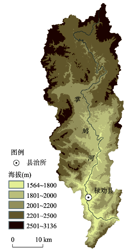
Fig. 1. The study area
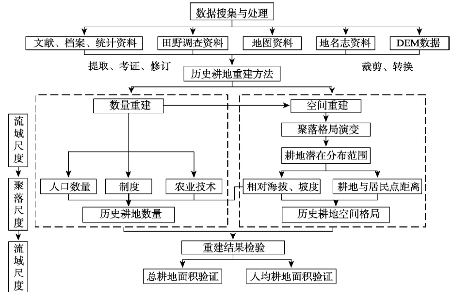
Fig. 2. The technical route
Fig. 3. Spatial pattern of cropland in the Zhangjiu River Basin in 1700
Fig. 4. Spatial pattern of cropland in the Zhangjiu River Basin at a 30 m × 30 m resolution from 1700 to 1978
Fig. 5. Reclamation rates on different terrain types in the Zhangjiu River Basin from 1700 to 1978
Fig. 6. Changes in per capita cropland area in the Zhangjiu River Basin from 1700 to 1978
|
Table 1. Relationship between cropland reclamation area, population, and agricultural technology in mountainous settlements in Yunnan Province
|
Table 2. Coefficients of population driving changes in cropland areas in settlements on different terrain types of settlements in the Zhangjiu River Basin from 1700 to 1978
|
Table 3. Coefficients of institutional and policy factors driving changes in cropland areas on different terrain types in the Zhangjiu River Basin from 1700 to 1978
|
Table 4. Coefficients of water conservation technology driving changes in cropland areas on different terrain types in the Zhangjiu River Basin from 1700 to 1978
|
Table 5. Coefficients of anthropogenic factors driving changes in cropland areas on different terrain types in the Zhangjiu River Basin from 1700 to 1978
|
Table 6. Settlement density and potential cropland radii for different terrain types in the Zhangjiu River Basin
|
Table 7. Total cropland area and per capita cropland area for different terrain types in the Zhangjiu River Basin in 1700
|
Table 8. Cropland area in the Zhangjiu River Basin from 1700 to 1978 (hm2)


Set citation alerts for the article
Please enter your email address

© Copyright 2018-2021 | Chinese Laser Press. All Rights Reserved 沪ICP备15018463号-20