
Yong Fang, Bincai Cao, Li Gao, Haiyan Hu, Zhenzhi Jiang. Development and application of lidar mapping satellite[J]. Infrared and Laser Engineering, 2020, 49(11): 20201044
- Infrared and Laser Engineering
- Vol. 49, Issue 11, 20201044 (2020)
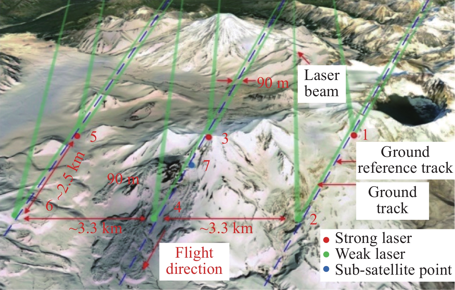
Fig. 1. Diagram of ICESat-2 ground beam geometry

Fig. 2. Comparison of photon counting lidar point cloud denoising effects
Fig. 3. Diagram of laser on-orbit calibration based on localized well-surveyed terrain
Fig. 4. Horizontal accuracy assessment of ICESat-2 using airborne data
Fig. 5. Distribution of elevation residuals before and after ICESat-2 and ZY-3 joint adjustment
Fig. 6. Diagram of multi-source terrain fusion
Fig. 7. Diagram of canopy height calculation based on ICESat-2 point clouds
Fig. 8. Schematic diagram of ICESat-2 shallow bathymetry. (a) Geographical location of Xisha Coral Island; (b) ICESat-2 photon profile point cloud and refraction correction effect; (c) Shallow water deep pseudo-color map
|
Table 1.
Main technical specifications and applications of earth observation laser altimetry equipment at home and abroad
国内外对地观测激光测高设备主要技术指标及用途
|
Table 2.
Basic parameters of ICESat-2
ICESat-2基本配置参数


Set citation alerts for the article
Please enter your email address

© Copyright 2018-2021 | Chinese Laser Press. All Rights Reserved 沪ICP备15018463号-20