• Laser & Optoelectronics Progress
  • Vol. 55, Issue 5, 052802 (2018)
Guanghao Ye1、1; , Susu Deng1、1; , Wenbing Xu1、2、1; 2; , and Zhengwen Niu1、1;
Author Affiliations
  • 1 School of Environmental & Resource Sciences, Zhejiang Agricultural & Forestry University, Lin'an, Zhejiang 311300, China;
  • 2 College of Surveying and Geo-Informatics, Tongji University, Shanghai 200092, China
  • show less
    DOI: 10.3788/LOP55.052802 Cite this Article Set citation alerts
    Guanghao Ye, Susu Deng, Wenbing Xu, Zhengwen Niu. Application of Airborne LiDAR Technology in Dune Deformation Monitoring[J]. Laser & Optoelectronics Progress, 2018, 55(5): 052802 Copy Citation Text show less
    Study area in White Sands Dune Field of USA
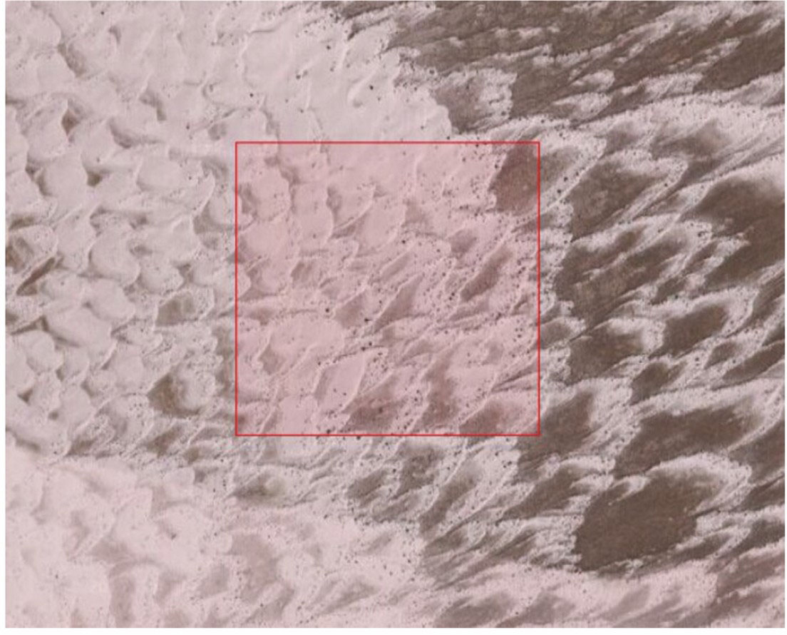
    Fig. 1. Study area in White Sands Dune Field of USA
    Flow chart of dune deformation monitoring method
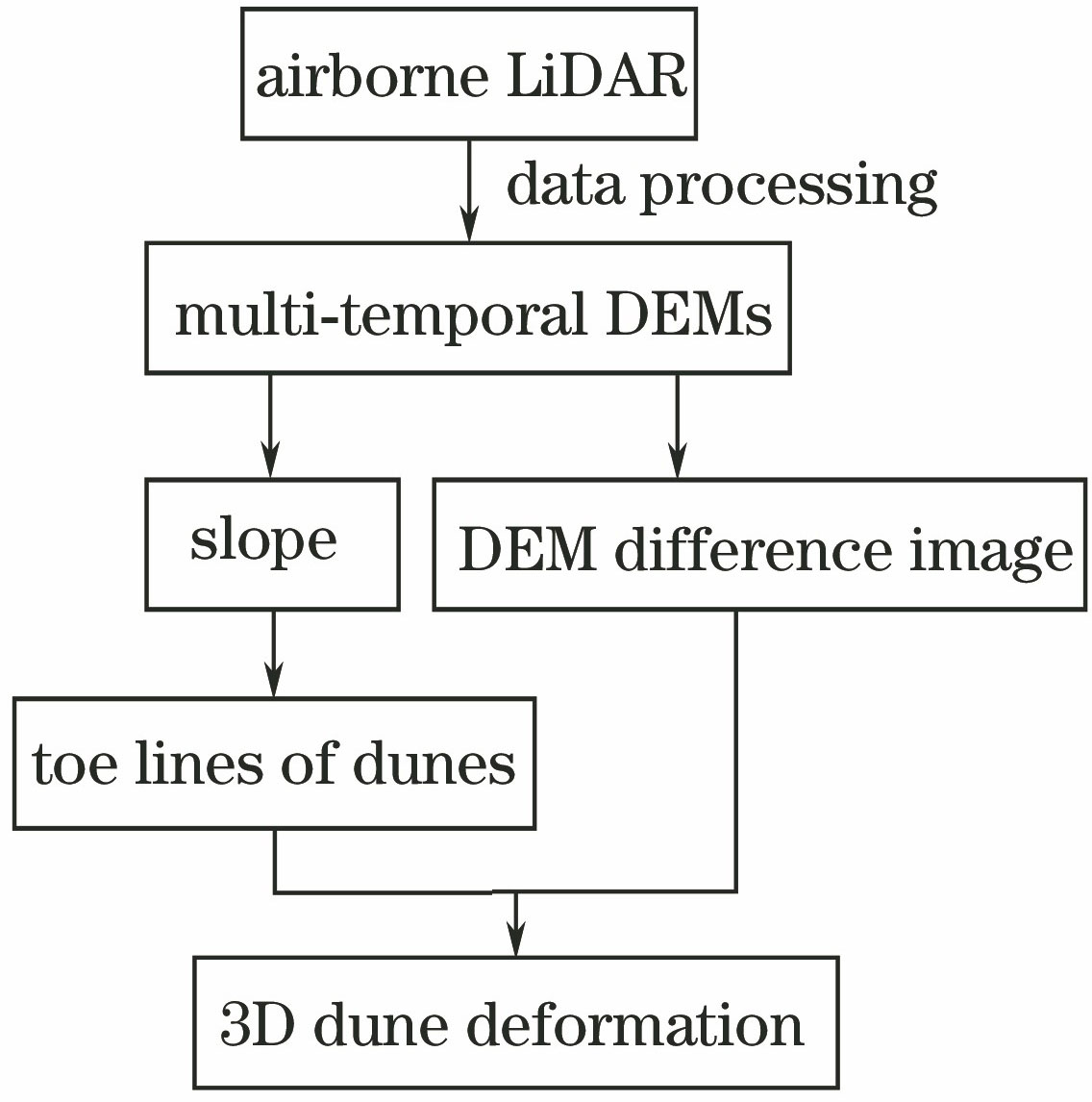
    Fig. 2. Flow chart of dune deformation monitoring method
    Morphological features of dunes
    Fig. 3. Morphological features of dunes
    Four subareas in study area
    Fig. 4. Four subareas in study area
    DEM of subarea 1
    Fig. 5. DEM of subarea 1
    Slope images of subareas. (a) Subarea 1; (b) subarea 2; (c) subarea 3; (d) subarea 4
    Fig. 6. Slope images of subareas. (a) Subarea 1; (b) subarea 2; (c) subarea 3; (d) subarea 4
    Toe lines of slip faces in subareas. (a) Subarea 1; (b) subarea 2; (c) subarea 3; (d) subarea 4
    Fig. 7. Toe lines of slip faces in subareas. (a) Subarea 1; (b) subarea 2; (c) subarea 3; (d) subarea 4
    DEM change and interpolate line locations of dune in subareas. (a) Subarea 1; (b) subarea 2; (c) subarea 3; (d) subarea 4
    Fig. 8. DEM change and interpolate line locations of dune in subareas. (a) Subarea 1; (b) subarea 2; (c) subarea 3; (d) subarea 4
    Elevation sectional views of dune in subareas. (a) Subarea 1; (b) subarea 2; (c) subarea 3; (d) subarea 4
    Fig. 9. Elevation sectional views of dune in subareas. (a) Subarea 1; (b) subarea 2; (c) subarea 3; (d) subarea 4
    SubareaMeanMinimumMaximum
    13.4121.3029.836
    21.7730.8484.543
    32.4450.5024.580
    42.1620.9114.907
    Table 1. Statistics of horizontal movement values of subarea dunesm
    SubareaMeanMinimumMaximumSTD
    10.327-1.6921.3000.207
    20.311-1.0291.1480.095
    30.258-1.6101.1860.144
    40.320-1.4351.9280.136
    Table 2. Statistics of elevation change values of subareasm
    SubareaMean ofnegative changesMean ofpositive changes
    1-0.8610.470
    2-0.2120.326
    3-0.1790.311
    4-0.2710.396
    Table 3. Mean of elevation change values along interpolate lines in subareasm
    Guanghao Ye, Susu Deng, Wenbing Xu, Zhengwen Niu. Application of Airborne LiDAR Technology in Dune Deformation Monitoring[J]. Laser & Optoelectronics Progress, 2018, 55(5): 052802
    Download Citation