• Journal of Natural Resources
  • Vol. 35, Issue 1, 162 (2020)
Hui-hui WANG1, Han-ting LI1, Miao-miao XIE1、2、*, Meng XU1, Shao-ling LI1, and Zhong-ke BAI1、2
Author Affiliations
  • 1School of Land Science and Technology, China University of Geosciences, Beijing 100083, China
  • 2Land Consolidation and Rehabilitation Center, Ministry of Natural Resources, Beijing 100035, China
  • show less
    DOI: 10.31497/zrzyxb.20200114 Cite this Article
    Hui-hui WANG, Han-ting LI, Miao-miao XIE, Meng XU, Shao-ling LI, Zhong-ke BAI. Construction of ecological security pattern for systematic restoration of industrial and mining land in resource-based cities[J]. Journal of Natural Resources, 2020, 35(1): 162 Copy Citation Text show less
    Study area and its land use
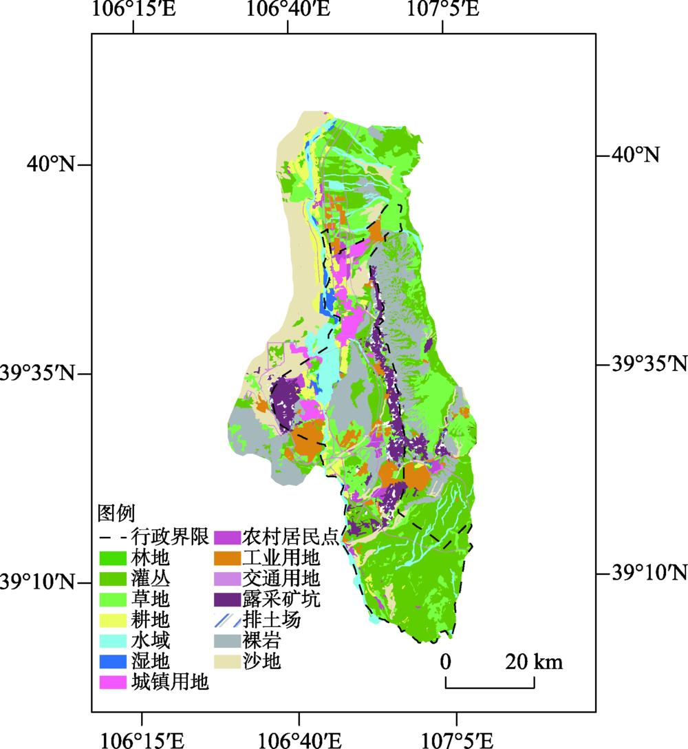
    Fig. 1. Study area and its land use
    Framework of ecological security pattern for resources-based cities in Northwest China
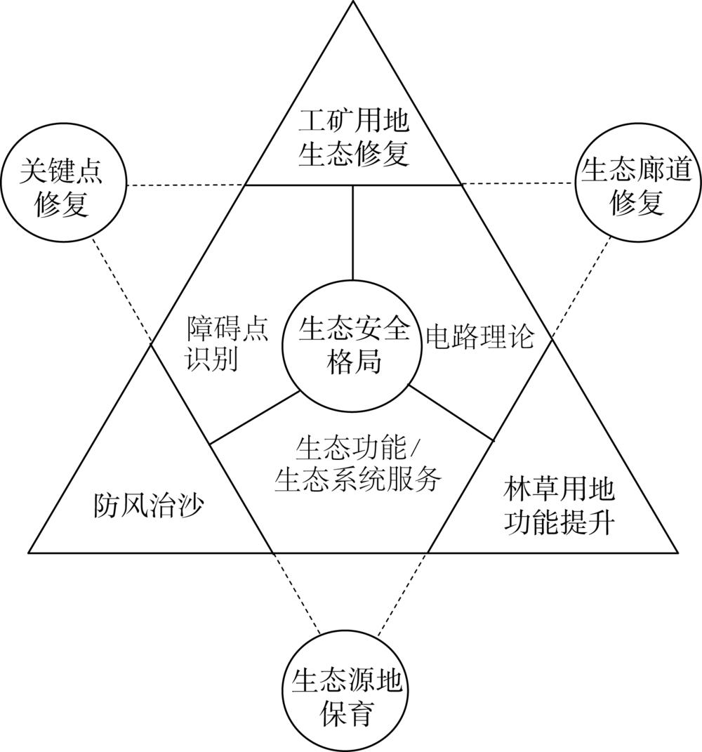
    Fig. 2. Framework of ecological security pattern for resources-based cities in Northwest China
    Ecological sources and resistance in the study area from 2000 to 2017
    Fig. 3. Ecological sources and resistance in the study area from 2000 to 2017
    LCP between ecological sources from 2000 to 2017
    Fig. 4. LCP between ecological sources from 2000 to 2017
    CWD of corridors between ecological sources from 2000 to 2017
    Fig. 5. CWD of corridors between ecological sources from 2000 to 2017
    Some details of corridors and barriers
    Fig. 6. Some details of corridors and barriers
    Ecological security pattern and important level of restoration priority of the resource-based city
    Fig. 7. Ecological security pattern and important level of restoration priority of the resource-based city
    Area of different land use types in lost corridors
    Fig. 8. Area of different land use types in lost corridors
    数据类型数据时间数据精度数据来源
    Landsat 5 TM遥感影像2000年8月、
    2005年7月、
    2011年6月
    30 m,云量
    低于5%
    USGS(美国地质勘探局,
    https://earthexplorer.usgs.gov/)
    Landsat 8 OLI遥感影像2017年8月
    谷歌影像图2019年3月第12级Google Earth
    土地利用类型数据2000年、2005年、
    2011年、2017年
    矢量数据中国科学院资源环境科学数据中心
    (http://www.resdc.cn)
    数字高程模型2010年30 m地理空间数据云
    研究区边界数据矢量数据国家基础地理信息中心、内蒙古自治区人民政府
    Table 1. Data sources and description
    土地利用类型修复关键点二级修复区
    林地04.28
    湿地01.98
    灌丛6.8644.23
    草地8.3736.60
    水域4.841.60
    耕地2.315.95
    其他地类24.300.36
    建设用地53.325.00
    Table 2. Land use type ratio of key points and secondary restoration area (%)
    Hui-hui WANG, Han-ting LI, Miao-miao XIE, Meng XU, Shao-ling LI, Zhong-ke BAI. Construction of ecological security pattern for systematic restoration of industrial and mining land in resource-based cities[J]. Journal of Natural Resources, 2020, 35(1): 162
    Download Citation