[1] et alMachine learning for the geosciences: Challenges and opportunities[J]. IEEE Transactions on Knowledge and Data Engineering, 31, 1544-1554(2019).
[2] et alDeep learning in remote sensing: A comprehensive review and list of resources[J]. IEEE Geoscience and Remote Sensing Magazine, 5, 8-36(2017).
[3] Deep learning for remote sensing data: A technical tutorial on the state of the art[J]. IEEE Geoscience and Remote Sensing Magazine, 4, 22-40(2016).
[4] A transdisciplinary review of deep learning research and its relevance for water resources scientists[J]. Water Resources Research, 54, 8558-8593(2018).
[7] et alUsing deep learning to examine street view green and blue spaces and their associations with geriatric depression in Beijing, China[J]. Environment International, 126, 107-117(2019).
[8] A framework for remote sensing images processing using deep learning techniques[J]. IEEE Geoscience and Remote Sensing Letters, 16, 25-29(2019).
[9] et alA graph convolutional neural network for classification of building patterns using spatial vector data[J]. ISPRS Journal of Photogrammetry and Remote Sensing, 150, 259-273(2019).
[10] Machine learning innovations in address matching: A practical comparison of word2vec and CRFs[J]. Transactions in GIS, 23, 334-348(2019).
[11] et alA spatiotemporal prediction framework for air pollution based on deep RNN[J]. Remote Sensing and Spatial Information Sciences, IV-4/W2, 15-22(2017).
[12] et alAn ensemble long short-term memory neural network for hourly PM2.5 concentration forecasting[J]. Chemosphere, 222, 286-294(2019).
[13] Towards geodesign: Repurposing cartography and GIS?[J]. Cartographic Perspectives, 66, 7-22(2010).
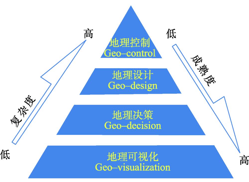
[14] 钟耳顺. 地理控制与实况地理学——关于GIS发展的思考[J]. 地球信息科学学报, 2013,15(6):783-792. [ Zhong ES. Geo-control and live geography: Some thoughts on the Direction of GIS[J]. Journal of Geo-information Science, 2013,15(6):783-792. ] [ Zhong E S. Geo-control and live geography: Some thoughts on the Direction of GIS[J]. Journal of Geo-information Science, 2013,15(6):783-792. ]
[15] 王劲峰, 葛咏, 李连发, 等. 地理学时空数据分析方法[J]. 地理学报, 2014,69(9):1326-1345. [ Wang JF, GeY, Li LF, et al. Spatiotemporal data analysis in geography[J]. Acta Geographica Sinica, 2014,69(9):1326-1345. ] [ Wang J F, Ge Y, Li L F, et al. Spatiotemporal data analysis in geography[J]. Acta Geographica Sinica, 2014,69(9):1326-1345. ]
[16] 王劲峰, 廖一兰, 刘鑫. 空间数据分析教程(第二版)[M]. 北京: 科学出版社, 2019. [ Wang JF, Liao YL, LiuX. Tutorial of spatial data analysis (second edtion)[M]. Beijing: Science Press, 2019. ] [ Wang J F, Liao Y L, Liu X. Tutorial of spatial data analysis (second edtion)[M]. Beijing: Science Press, 2019. ]
[17] et alMachine learning in geosciences and remote sensing[J]. Geoscience Frontiers, 7, 3-10(2016).
[18] 岳天祥. 地球表层建模研究进展[J]. 遥感学报, 2011,15(6):1111-1130. [ Yue TX. Progress in earth surface modeling. Journal of Remote Sensing, 2011,15(6):1111-1130. ] [ Yue T X. Progress in earth surface modeling. Journal of Remote Sensing, 2011,15(6):1111-1130. ]
[19] Deep learning[J]. Nature, 521, 436-444(2015).
[20] et alIs second-order information helpful for large-scale visual recognition?[C]. Proceedings of the IEEE International Conference on Computer Vision, 2089-2097(2017).
[21] et alFeature pyramid Networks for object detection[C]. 2017 IEEE Conference on Computer Vision and Pattern Recognition (CVPR), 936-944(2017).
[22] et alSpeed/Accuracy trade-offs for modern convolutional object detectors[C]. 2017 IEEE Conference on Computer Vision and Pattern Recognition (CVPR), 3296-3297(2017).
[23] et alLearning efficient object detection models with knowledge distillation[C]. Advances in Neural Information Processing Systems, 743-752(2017).
[24] Deeper and wider siamese networks for real-time visual tracking[C]. The IEEE Conference on Computer Vision and Pattern Recognition (CVPR)(2019).
[25] et alFully-convolutional siamese networks for object tracking[C]. European conference on computer vision, 850-865(2016).
[26] et alSemantic understanding of scenes through the ADE20K dataset[J]. International Journal of Computer Vision, 127, 302-321(2019).
[27] 呼延康, 樊鑫, 余乐天, 等. 图神经网络回归的人脸超分辨率重建[J]. 软件学报, 2018,29(4):914-925. [ Hu YK, FanX, Yu LT, Luo ZX, Graph based neural network regression strategy for facial image super-resolution[J]. Journal of Software, 2018, 29(4):914-925. ]. [ Hu Y K, Fan X, Yu L T, Luo Z X. Graph based neural network regression strategy for facial image super-resolution[J]. Journal of Software, 2018,29(4):914-925. ].
[28] et alImage super-resolution using very deep residual channel attention networks[C]. Proceedings of the European Conference on Computer Vision (ECCV), 286-301(2018).
[29] et alSecond-order attention network for single image super-resolution[C]. Proceedings of the IEEE Conference on Computer Vision and Pattern Recognition, 11065-11074(2019).
[30] et alDeep learning and process understanding for data-driven Earth system science[J]. Nature, 566, 195-204(2019).
[31] et alDeep learning for hyperspectral image classification: An overview[J]. IEEE Transactions on Geoscience and Remote Sensing, 57, 6690-6709(2019).
[32] et alFCN-rLSTM: Deep spatio-temporal neural networks for vehicle counting in city cameras[C]. 2017 IEEE International Conference on Computer Vision (ICCV), 3687-3696(2017).
[34] et alDeep learning architecture for air quality predictions[J]. Environmental Science and Pollution Research, 23, 22408-22417(2016).
[35] et alHigh-resolution air pollution mapping with google street view cars: Exploiting big data[J]. Environmental Science and Technology, 51, 6999-7008(2017).
[36] et alA hybrid model for spatiotemporal forecasting of PM2.5 based on graph convolutional neural network and long short-term memory[J]. Science of the Total Environment, 664, 1-10(2019).
[37] A deep spatial-temporal ensemble model for air quality prediction[J]. Neurocomputing, 314, 198-206(2018).
[38] et alExplore a deep learning multi-output neural network for regional multi-step-ahead air quality forecasts[J]. Journal of Cleaner Production, 209, 134-145(2019).
[39] et alMiST: A multiview and multimodal spatial-temporal learning framework for citywide abnormal event forecasting[C]. The World Wide Web Conference on WWW '19, 717-728(2019).
[40] et alPredicting citywide crowd flows using deep spatio-temporal residual networks[J]. Artificial Intelligence, 259, 147-166(2018).
[41] et alDiffusion convolutional recurrent neural network: Data-driven traffic forecasting[C]. International conference on learning representations (ICLR '18), 1-16(2018).
[42] Land cover classification from satellite imagery with U-Net and lovász-Softmax loss[J]. 2018 IEEE/CVF conference on computer vision and pattern recognition workshops (CVPRW): IEEE, 257-2574(2018).
[43] et alDeep aggregation Net for land cover classification[J]. The IEEE conference on computer vision and pPattern recognition (CVPR), 252-256(2018).
[44] Land cover classification with superpixels and jaccard index post-optimization[C]. 2018 IEEE/CVF conference on computer vision and pattern recognition workshops (CVPRW), 280-2804(2018).
[45] et alA review of supervised object-based land-cover image classification[J]. ISPRS Journal of Photogrammetry and Remote Sensing, 130, 277-293(2017).
[46] D-LinkNet: LinkNet with pretrained encoder and dilated convolution for high resolution satellite imagery road extraction[C]. 2018 IEEE/CVF Conference on Computer Vision and Pattern Recognition Workshops (CVPRW), 1922-1924(2018).
[47] et alStacked U-Nets for ground material segmentation in remote sensing imagery[C]. 2018 IEEE/CVF Conference on Computer Vision and Pattern Recognition Workshops (CVPRW), 252-2524(2018).
[48] Reproducibility in machine learning-based studies: An example from text mining[C]. ICML Reproducibility in ML Workshop, 471-486(2017).
[49] Artificial intelligence faces reproducibility crisis[J]. Science, 359, 725-726(2018).
[50] 周成虎. 全空间地理信息系统展望[J]. 地理科学进展, 2015,34(2):129-131. [ Zhou CH. Prospects on pan-spatial information system[J]. Progress in geography, 2015,34(2):129-131. ] [ Zhou C H. Prospects on pan-spatial information system[J]. Progress in geography, 2015,34(2):129-131. ]
[51] 龚健雅. 人工智能时代测绘遥感技术的发展机遇与挑战[J]. 武汉大学学报·信息科学版, 2018,43(12):1788-1788. [ Gong JY. Chances and challenges for development of surveying and remote sensing in the age of artificial intelligence[J]. Geomatics and Information Science of Wuhan University, 2018,43(12):1788-1796. ] [ Gong J Y. Chances and challenges for development of surveying and remote sensing in the age of artificial intelligence[J]. Geomatics and Information Science of Wuhan University, 2018,43(12):1788-1796. ]
[52] IMU aided RGB-D SLAM[C]. 2017 14 th International bhurban conference on applied sciences and technology (IBCAST), 337-341(2017).
[53] Design of an indoor mapping system using three 2D laser scanners and 6 DOF SLAM[J]. ISPRS Annals of Photogrammetry, Remote Sensing and Spatial Information Sciences, II-3, 173-179(2014).
[54] et alKeyframe-based monocular SLAM: Design, survey, and future directions[J]. Robotics and Autonomous Systems, 98, 67-88(2017).
[55] Visual-Inertial Navigation: A concise review[C]. 2019 International Conference on Robotics and Automation (ICRA), 9572-9582(2019).
[56] Performance evaluation of 3D keypoint detectors[J]. International Journal of Computer Vision, 102, 198-220(2013).
[57] 孔云峰. 地理视频数据模型设计及网络视频GIS实现[J]. 武汉大学学报: 信息科学版, 2010,35(2):133-137. [ Kong YF. Design of Geovideo data model and implementation of web-based videoGIS[J]. Geomatics and Information Science of Wuhan University, 2010,35(2):133-137. ] [ Kong Y F. Design of Geovideo data model and implementation of web-based videoGIS[J]. Geomatics and Information Science of Wuhan University, 2010,35(2):133-137. ]
[58] 张兴国, 刘学军, 王思宁, 等. 监控视频与2D地理空间数据互映射[J]. 武汉大学学报(信息科学版), 2015,40(8):1130-1136. [ Zhang XG, Liu XJ, Wang SN, LiuY. Mutual mapping between surveillance video and 2D geospatial data[J]. Geomatics and Information Science of Wuhan University, 2015,40(8):1130-1136. ] [ Zhang X G, Liu X J, Wang S N, Liu Y. Mutual mapping between surveillance video and 2D geospatial data[J]. Geomatics and Information Science of Wuhan University, 2015,40(8):1130-1136. ]
[59] Spatial video and GIS[J]. International Journal of Geographical Information Science, 25, 697-716(2011).
[60] GIS-augmented video surveillance[J]. International Journal of Geographical Information Science, 24, 1415-1433(2010).
[61] A critique of pure learning and what artificial neural networks can learn from animal brains[J]. Nature Communications, 10, 3770(2019).
[62] et alVector-based navigation using grid-like representations in artificial agents[J]. Nature, 557, 429-433(2018).
[63] et alTowards artificial general intelligence with hybrid Tianjic chip architecture[J]. Nature, 572, 106-111(2019).