• Journal of Geo-information Science
  • Vol. 22, Issue 1, 76 (2020)
Guanfu SONG1、1、2、2、3、3、*, Hao LU1、1、2、2, Chenliang WANG3、3, Chenpu HU1、1、2、2, and Kejia HUANG1、1、2、2
Author Affiliations
  • 1SuperMap Software Company Limited, Beijing 100015, China
  • 1北京超图软件股份有限公司,北京 100015
  • 2GIS Technology Innovation Center of Ministry of Natural Resources, Beijing 100015, China
  • 2自然资源部地理信息系统技术创新中心,北京 100015
  • 3Institute of Geographic Sciences and Natural Resources Research, Chinese Academy of Sciences, Beijing 100101, China
  • 3中国科学院地理科学与资源研究所,北京 100101
  • show less
    DOI: 10.12082/dqxxkx.2020.190701 Cite this Article
    Guanfu SONG, Hao LU, Chenliang WANG, Chenpu HU, Kejia HUANG. A Tentative Study on System of Software Technology for Artificial Intelligence GIS[J]. Journal of Geo-information Science, 2020, 22(1): 76 Copy Citation Text show less
    Geo-intelligence pyramid
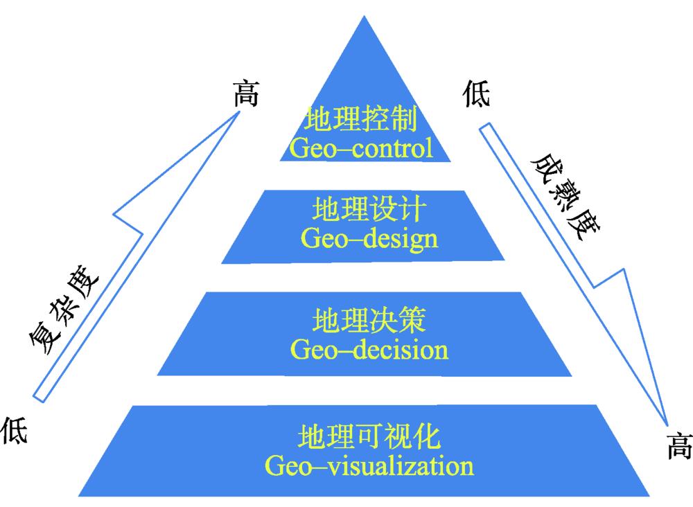
    Fig. 1. Geo-intelligence pyramid
    The structure of AI GIS technologies
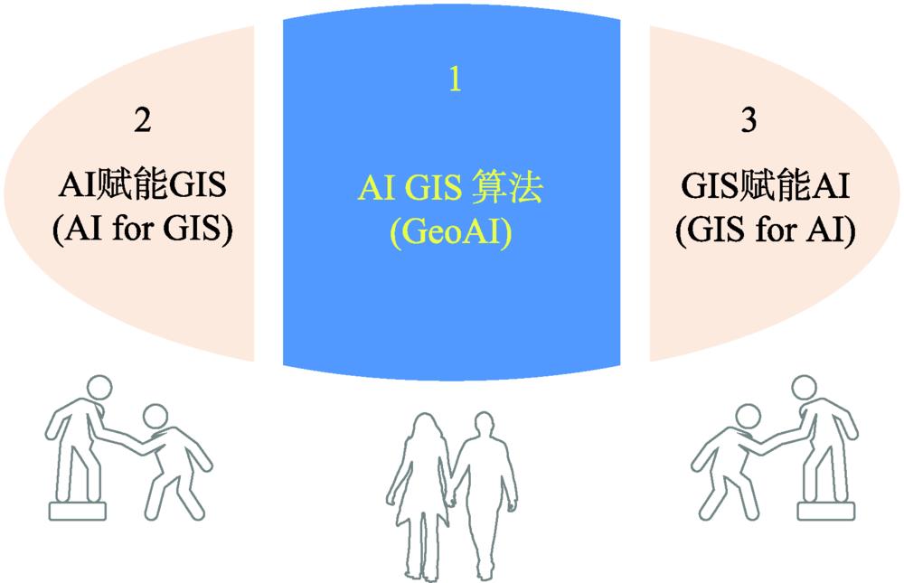
    Fig. 2. The structure of AI GIS technologies
    Components of GeoAI
    Fig. 3. Components of GeoAI
    Algorithms of spatial statistics
    Fig. 4. Algorithms of spatial statistics
    Algorithms of geospatial machine learning
    Fig. 5. Algorithms of geospatial machine learning
    Algorithms of geospatial deep learning
    Fig. 6. Algorithms of geospatial deep learning
    GeoAI pipeline
    Fig. 7. GeoAI pipeline
    Reporting of law enforcement cases based on image classification technology
    Fig. 8. Reporting of law enforcement cases based on image classification technology
    Feature point generation based on visual-inertial system
    Fig. 9. Feature point generation based on visual-inertial system
    Flowchart of AI Cartography
    Fig. 10. Flowchart of AI Cartography
    Air map operation based on hand gesture recognition
    Fig. 11. Air map operation based on hand gesture recognition
    Air map operation based on human gesture recognition
    Fig. 12. Air map operation based on human gesture recognition
    Geo-fencing real-time alert system
    Fig. 13. Geo-fencing real-time alert system
    AI GIS technology architecture
    Fig. 14. AI GIS technology architecture
    AI GIS product architecture (illustrated by the example of SuperMap)
    Fig. 15. AI GIS product architecture (illustrated by the example of SuperMap)
    软件类别软件模块数据准备模型构建模型应用
    服务器GISSuperMap iServer 机器学习服务
    SuperMap iServer数据科学服务
    桌面GISSuperMap iDesktopX
    组件式GISSuperMap iObjects Python
    Table 1. SuperMap AI Pipeline Toolkits
    Guanfu SONG, Hao LU, Chenliang WANG, Chenpu HU, Kejia HUANG. A Tentative Study on System of Software Technology for Artificial Intelligence GIS[J]. Journal of Geo-information Science, 2020, 22(1): 76
    Download Citation