
Guoyuan Li, Xinming Tang, Ping Zhou, Jiyi Chen, Zhao Liu, Xianhui Dou, Xiaoqing Zhou, Xia Wang. Laser altimetry data processing and combined surveying application of ZY3-03 satellite[J]. Infrared and Laser Engineering, 2022, 51(5): 20210356
- Infrared and Laser Engineering
- Vol. 51, Issue 5, 20210356 (2022)
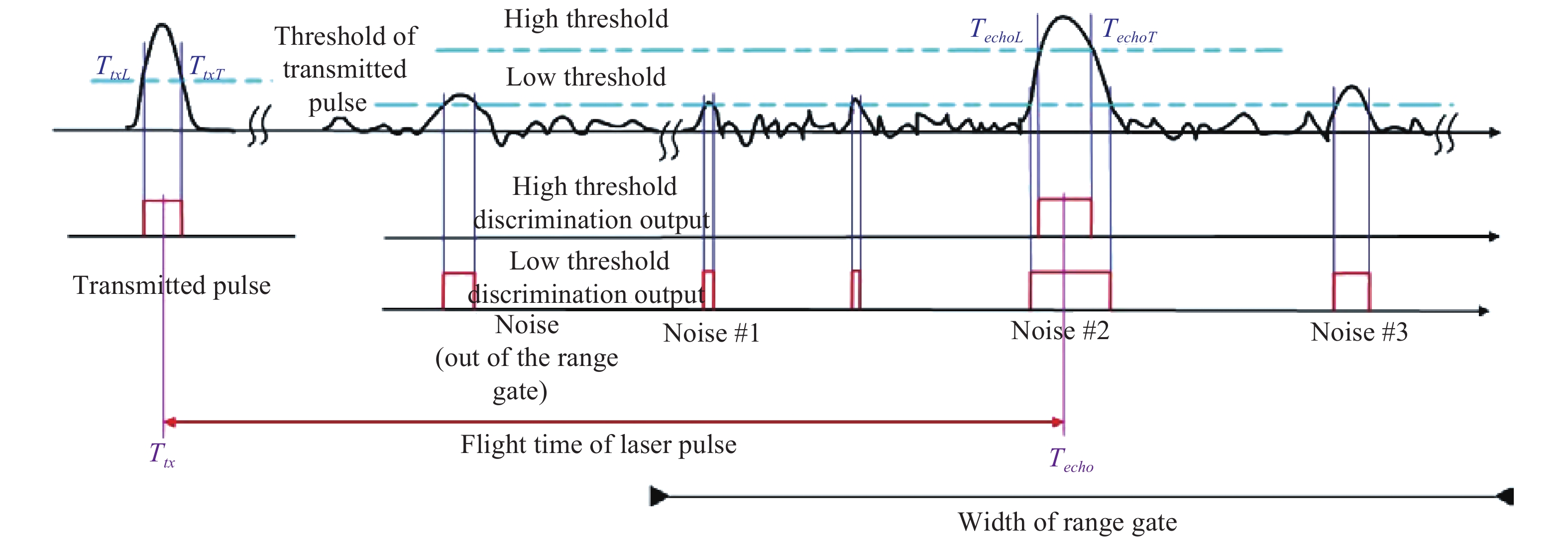
Fig. 1. Diagram of ZY3-03 satellite laser altimeter based on the threshold detection and ranging
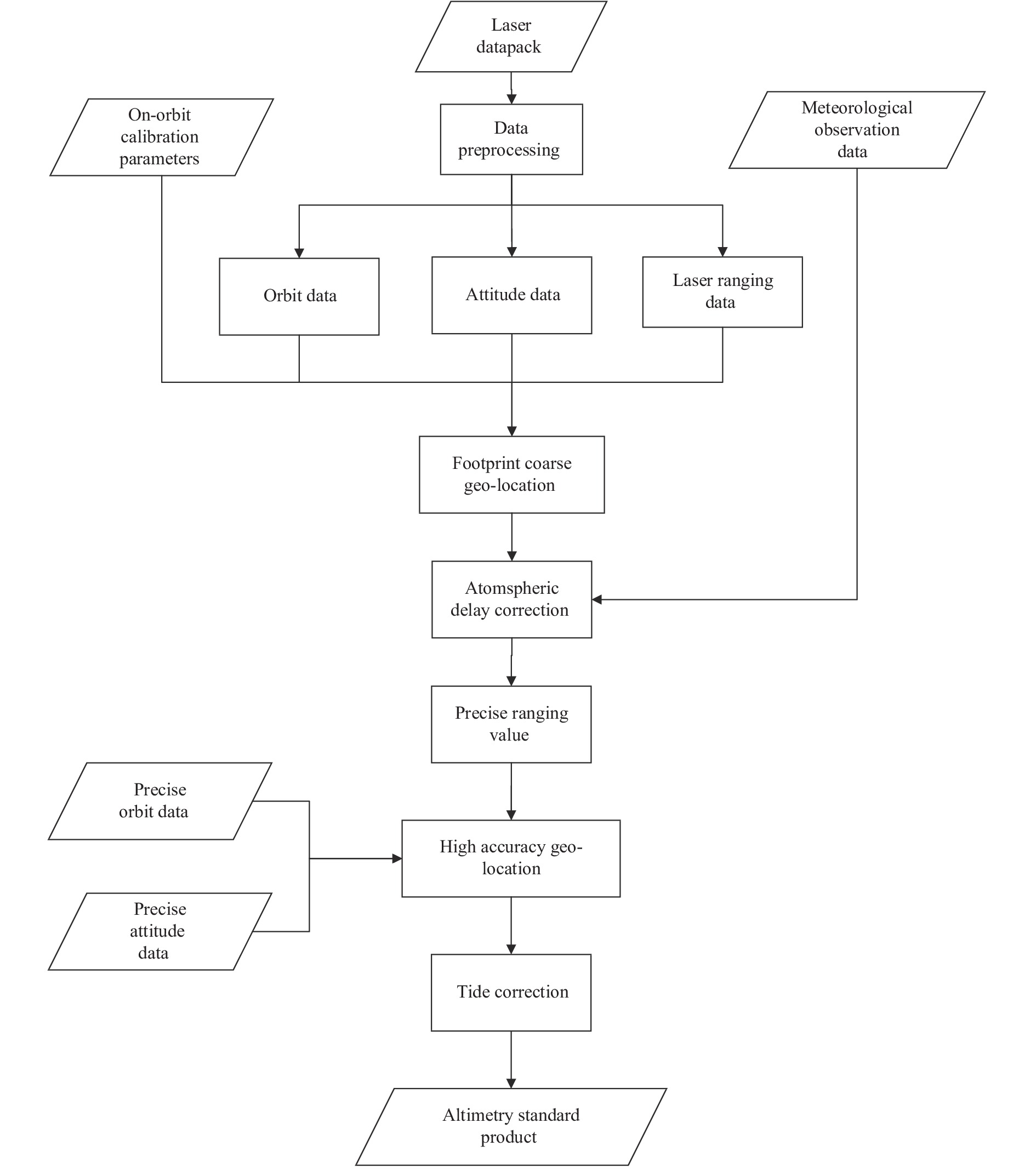
Fig. 2. The workflow of ZY3-03 satellite laser altimetry data processing
Fig. 3. Distribution of ZY3-03 satellite laser altimetry points all over the world
Fig. 4. Illustration of RTK-GPS for validation in filed surveying
Fig. 5. Distribution of combined surveying data and field check points in experimental regions
|
Table 1. Parameters comparison between ZY3-02 and ZY3-03 satellite laser altimeter
| ||||||||||||||||||||||||||||||||||||||||||||||||
Table 2. Validation result of ZY3-03 laser points on Sunid Right Banner in Inner Mongolia (Unit: m)
|
Table 3. Laser elevation accuracy of the No.1183 orbit on 10thOct, 2020 (Unit: m)
| ||||||||||||||||||||||||||||||||||||||||||||||||||||||||||||||||||||
Table 4. Statistics result of different adjustment in the experimental regions


Set citation alerts for the article
Please enter your email address

© Copyright 2018-2021 | Chinese Laser Press. All Rights Reserved 沪ICP备15018463号-20