
Hao Liu, Dong Liu, HongXia Mao, ZhiHe Xiao. Infrared dynamic scene generation of rocket plume observed by satellite[J]. Infrared and Laser Engineering, 2021, 50(7): 20200519
- Infrared and Laser Engineering
- Vol. 50, Issue 7, 20200519 (2021)
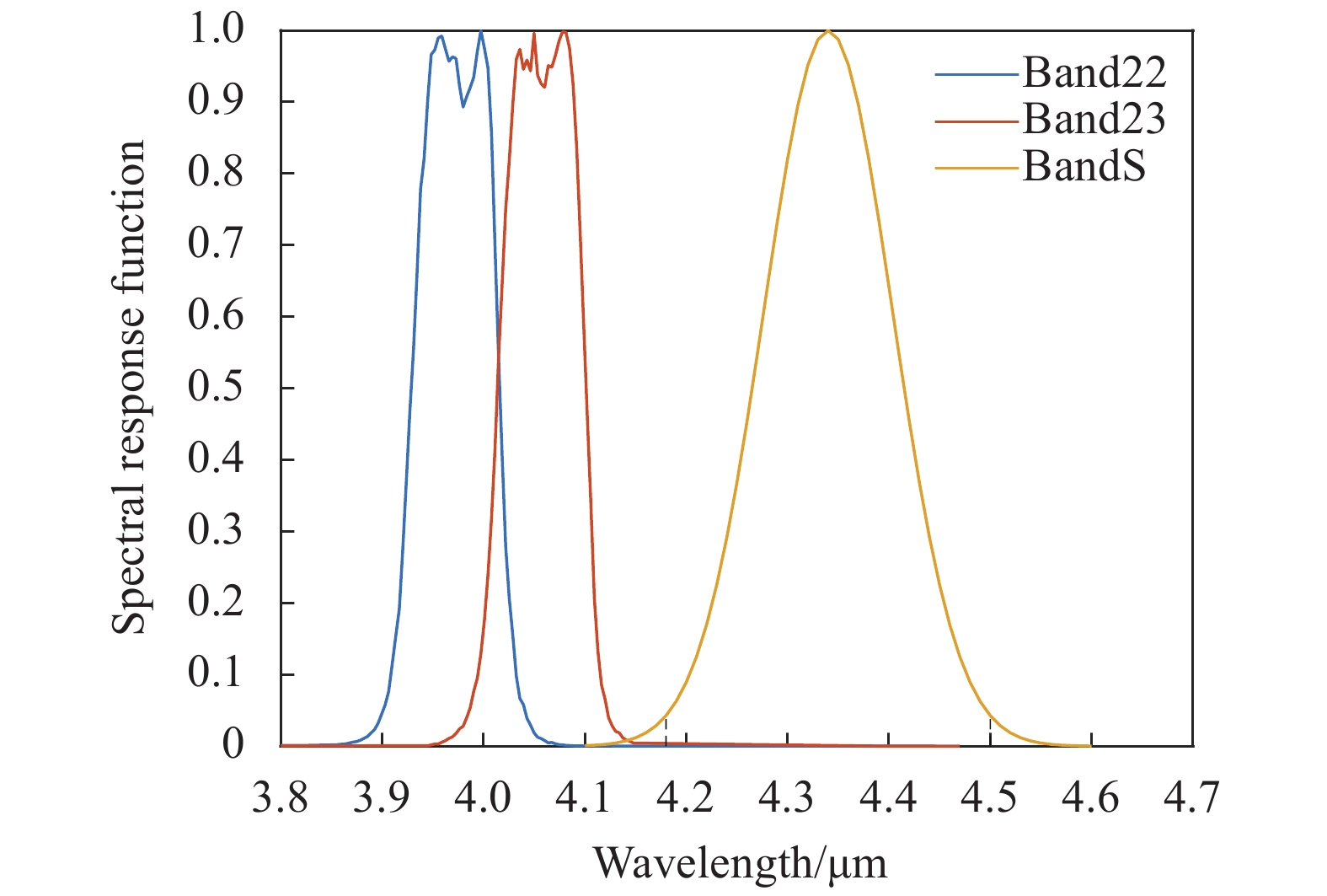
Fig. 1. Spectral response functions of Band22, Band23 and BandS
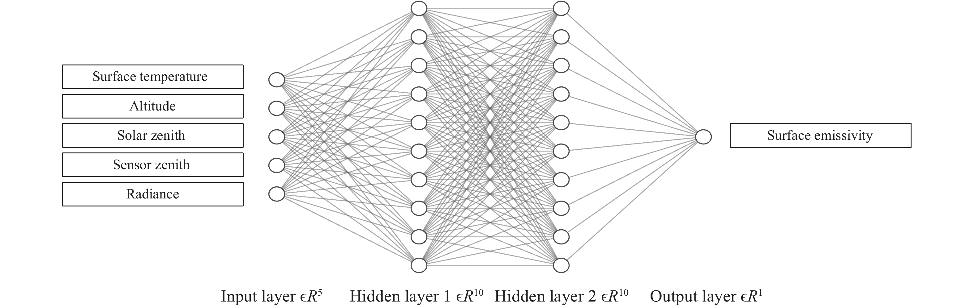
Fig. 2. Schematic of neural networks for retrieving surface emissivity
Fig. 3. Surface emissivity images with a resolution of 100 meters
Fig. 4. Spectral emissivity in the 3.8-4.6 μm band of 4 categories including soil (a), vegetation (b), water (c) and manmade materials (d)
Fig. 5. Coefficient of determination R 2 of spectrum correlation algorithm
Fig. 6. Schematic of the LOS method
Fig. 7. Schematic of infrared dynamic scene generation of rocket plume observed by satellite
Fig. 8. Schematic of projection imaging of rocket plume and background from satellite
Fig. 9. Comparison of the plume spectral radiation intensity between calculated and measured
Fig. 10. Average relative error between the results of spectrum correlation algorithm and JHU spectrum library
Fig. 11. Relative error of radiance under different atmospheric models and viewing zenith angles
Fig. 12. Part of radiance images on the rocket trajectory
Fig. 13. Plume length and number of pixels on the rocket trajectory
Fig. 14. Total radiation intensity trend on the rocket trajectory
Fig. 15. Total radiation intensity trend on different trajectories of scene 1
Fig. 16. Total radiation intensity trend on different trajectories of scene 2
|
Table 1. Introduction to MODIS data
|
Table 2. MSE of training set, validation set and test set
| ||||||||||||||||||||||
Table 3. Scene simulation parameters


Set citation alerts for the article
Please enter your email address

© Copyright 2018-2021 | Chinese Laser Press. All Rights Reserved 沪ICP备15018463号-20