
Yili ZHANG, Xue WU, Du ZHENG. Vertical variation of land cover in the Central Himalayas [J]. Acta Geographica Sinica, 2020, 75(5): 931
- Acta Geographica Sinica
- Vol. 75, Issue 5, 931 (2020)
Abstract
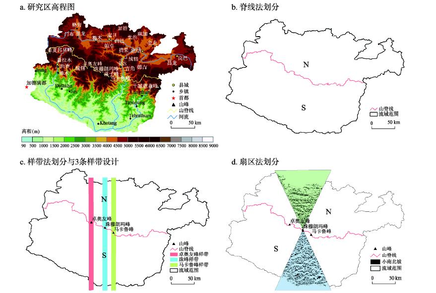
Firstly, the distribution of land cover in mountainous areas was characterized by an obvious vertical spectrum structure, with the south-six and north-four pattern of vertical spectrum of land cover in the Central Himalayas marked by the influence of human activities. Secondly, zonal distribution was exhibited by forests, grasslands, sparse vegetation, barren land, glaciers, and snow covers from low to high altitudes. It was markedly different in the composition and structure of land cover vertical spectrum between the northern and southern slopes of this mountain area. The vertical spectrum of land cover types on the southern slope was complete and diverse, but it was relatively simple on the northern slope. The study shows that given the same land cover type, the amplitude of elevation distribution on the southern slope was wide, while that on the northern slope was narrow. The distribution of land cover types on the southern slope was low. Thirdly, the results show that the area distribution ratio of each land cover type varied with elevation according to change mode. Vertical distribution patterns of land cover types on the southern and northern slopes were therefore divided into four categories, with glaciers, snow, sparse vegetation, and grasslands conforming to unimodal distribution patterns. The bare land also followed a unimodal distribution pattern on the southern slope, but it followed a bimodal one on the northern slope. Fourthly, all kinds of vertical belt structures and land cover divisions on the southern slope were similar, but they were different from one another on the northern slope due to division methods. In comparison with field survey data, results reported here for the sector method were more in line with the actual situation.


Set citation alerts for the article
Please enter your email address

© Copyright 2018-2021 | Chinese Laser Press. All Rights Reserved 沪ICP备15018463号-20