| Natural force | Average annual precipitation | mm | Measures the livability of climatic conditions via the average annual precipitation of county-level units | China Meteorological Data Service Center (CMDC) | 0.25 |
| Average annual temperature | ℃ | Measures the livability of climatic conditions via the average annual temperature of county-level units | China Meteorological Data Service Center (CMDC) | 0.25 |
| Average altitude | km | Measures the topographic conditions in border areas via average elevation of county-level units | Geospatial Data Cloud | 0.25 |
| Arable land area | ha | Measures the scale of arable land in border areas | China Economic and Social Development Statistics Database | 0.25 |
| Administrative force | Local fiscal expenditure | 10,000 RMB | Measures the administrative and regulatory capacity of local governments | China Statistical Yearbook (County-Level) | 0.3 |
| Public and private fixed-asset investment | 10,000 RMB | Measures the economic capacity of local governments | China Statistical Yearbook (County-Level) | 0.3 |
| Preferential policy index | / | Measures national policy support (at a scale of 0-5 based on the following five policy conditions) 1 = West China Development and Northeast Revitalization programs2 = Pilot for supporting reforms along borders and pilot for supporting reform of modern agriculture3 = Border economic cooperation zone, comprehensive free trade zone or “prosperity to border areas and their residents” pilots4 = Key experimental zones for development and opening up 5 = Cross-border economic cooperation zones | Websites of Ministry of Commerce and National Development and Reform Commission | 0.4 |
| Market force | Total retail sales of consumer goods | 10,000 RMB | Measures the size of domestic markets in border areas | China Statistical Yearbook (County-level) | 0.4 |
| Bilateral trade | 10,000 USD | Measures the level of trade development in border areas | International Trade Centre databases | 0.2 |
| Bilateral economic integration | / | Measures the bilateral trade environment (with integration scores of 0-3)0 = The two countries have no trade agreement1 = Both countries have joined economic organizations or agreements, such as WTO, CAFTA, BRI, etc. 2 = Countries are in bilateral trade negotiations3 = Countries have signed a bilateral free trade agreement | Websites of Ministry of Commerce and National Development and Reform Commission | 0.2 |
| Market opportunities | / | Measures market size, market expectations, etc., of neighboring countries in border areas (expressed as per capita GDP of neighboring country/per capita GDP of border area) | China Statistical Yearbook (County-level) & World Bank databases | 0.2 |
| Industrial force | Industrial output | 10,000 RMB | Measures the level of industrialization | China Statistical Yearbook (County-level) | 0.4 |
| Tourism revenue | Million USD | Measures the level of development of tourism | China Statistical Yearbook | 0.3 |
| GRP | 100 million RMB | Measures overall industrial development | China Statistical Yearbook (County-level) | 0.3 |
| Transportation force | Transport route density | km/km2 | Measures level of transportation access to China’s hinterland (the ratio of the length of transport routes to the administrative area, including road and rail routes) | China Statistical Yearbook | 0.4 |
| Transport status | / | Determines whether a county is an important transportation node in China’s opening up drive | Websites of Ministry of Commerce and National Development and Reform Commission | 0.3 |
| Air transport development | / | Measures the level of aviation development (0-3 assigned based on airport construction)0 = No airport of category 3C or higher1 = has a 3C airport2 = has a 4C airport3 = has a 4D airport | General Aviation Resource Net of China | 0.3 |
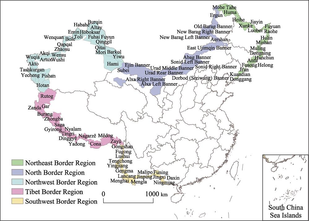
| Social force | Proportion of population made up of ethnic minorities | / | Measures social and cultural integration with neighboring countries | Census | 0.4 |
| Education level | People | Number of primary and secondary school students and ordinary middle school students per 10,000 people | China Statistical Yearbook (County-level) | 0.3 |
| Medical care level | Beds | Number of beds in medical institutions per 10,000 people | China Statistical Yearbook (County-level) | 0.3 |