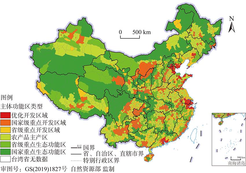

He-lin LIU, Jing-xin NIE. The changes of the spatial distribution of China's national and provincial development zones from 2006 to 2018[J]. Journal of Natural Resources, 2020, 35(9): 2229
- Journal of Natural Resources
- Vol. 35, Issue 9, 2229 (2020)
Abstract


Set citation alerts for the article
Please enter your email address

© Copyright 2018-2021 | Chinese Laser Press. All Rights Reserved 沪ICP备15018463号-20