• Laser & Optoelectronics Progress
  • Vol. 55, Issue 6, 062803 (2018)
Wang Guo* and Xiaojun Cheng
Author Affiliations
  • College of Surveying and Geo-Informatics, Tongji University, Shanghai 200092, China
  • show less
    DOI: 10.3788/LOP55.062803 Cite this Article Set citation alerts
    Wang Guo, Xiaojun Cheng. Registration Method for Airborne and Terrestrial Light Detection and Ranging Point Cloud Based on Laser Intensity Classification[J]. Laser & Optoelectronics Progress, 2018, 55(6): 062803 Copy Citation Text show less
    Corrected intensity images of (a) airborne and (b) terrestrial LiDAR
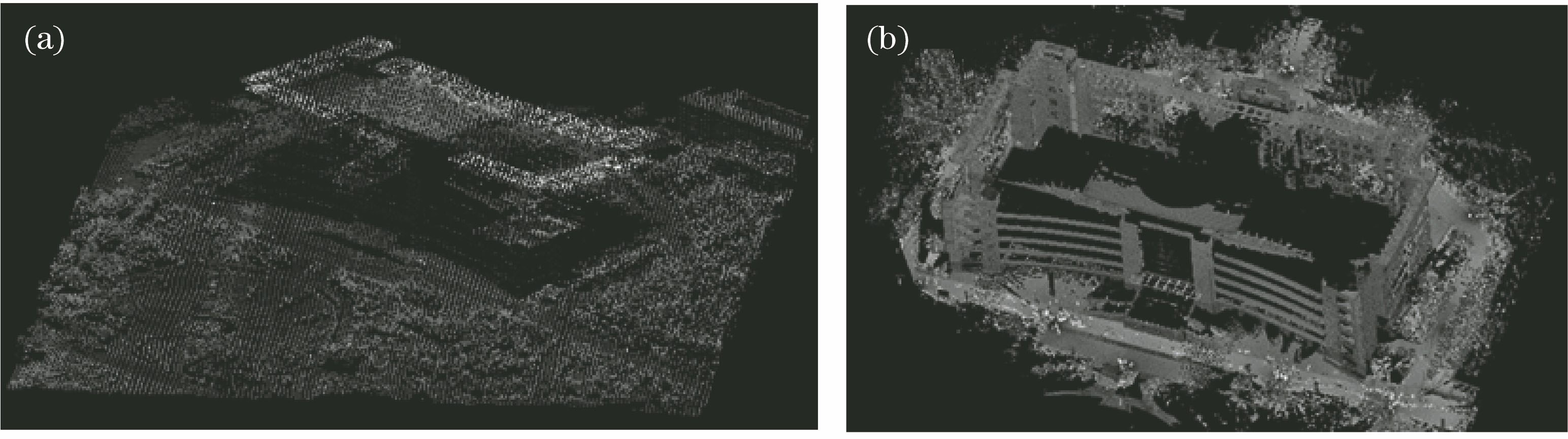
    Fig. 1. Corrected intensity images of (a) airborne and (b) terrestrial LiDAR
    Intensity classification images of (a) airborne and (b) terrestrial LiDAR
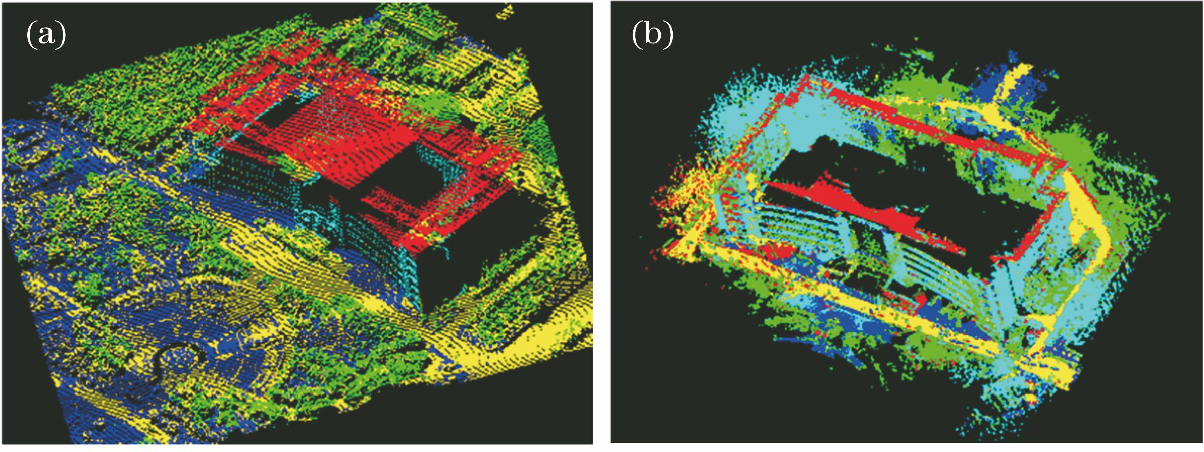
    Fig. 2. Intensity classification images of (a) airborne and (b) terrestrial LiDAR
    Extracted plane features of (a) airborne and (b) terrestrial LiDAR
    Fig. 3. Extracted plane features of (a) airborne and (b) terrestrial LiDAR
    Corresponding plane features of (a) airborne and (b) terrestrial LiDAR
    Fig. 4. Corresponding plane features of (a) airborne and (b) terrestrial LiDAR
    Registration results. (a) Front view; (b) top view; (c) side view
    Fig. 5. Registration results. (a) Front view; (b) top view; (c) side view
    Registering error distribution
    Fig. 6. Registering error distribution
    TypeRoofWallVegetationRoadGround
    ColorRedCyanGreenYellowBlue
    Table 1. Classification of features
    R11R12R13R21R22R23R31R32R33Δx /mΔy /mΔz /m
    -0.317180.94783-0.03153-0.94797-0.31783-0.01809-0.027170.024150.9993423989.9213738861.257139.634
    Table 2. Coordinate transformation parameter values
    ErrortypeMaximum /mMinimum /mMean /mStandarddeviation /m
    Δx0.1890.0010.0660.0029
    Δy0.1920.0010.0740.0032
    Δz0.1930.0010.0650.0029
    Δd0.1990.0090.1380.0052
    Table 3. Registering accuracy
    ObjectiveAirborne distance /mTerrestrial distance /mDeviation /mMean /m
    Horizontal line 1114.635115.221-0.586-0.5442
    Horizontal line 2126.464127.037-0.573
    Horizontal line 334.98835.54-0.552
    Horizontal line 4114.42114.918-0.498
    Horizontal line 544.86345.375-0.512
    Vertical line 127.73828.242-0.504-0.476
    Vertical line 227.27527.753-0.478
    Vertical line 327.76628.208-0.442
    Vertical line 423.09823.614-0.516
    Vertical line 517.61218.052-0.44
    Table 4. Comparison of measurement between airborne and terrestrial LiDAR
    Wang Guo, Xiaojun Cheng. Registration Method for Airborne and Terrestrial Light Detection and Ranging Point Cloud Based on Laser Intensity Classification[J]. Laser & Optoelectronics Progress, 2018, 55(6): 062803
    Download Citation