• Acta Optica Sinica
  • Vol. 40, Issue 5, 0528001 (2020)
Yue Han, Song Li*, Shizhe Yu, Zhiyu Zhang, and Hui Zhou
Author Affiliations
  • Electronic Information School, Wuhan University, Wuhan, Hubei 430072, China
  • show less
    DOI: 10.3788/AOS202040.0528001 Cite this Article Set citation alerts
    Yue Han, Song Li, Shizhe Yu, Zhiyu Zhang, Hui Zhou. Laser Pointing Error Estimation Based on Energy Data of LOLA System[J]. Acta Optica Sinica, 2020, 40(5): 0528001 Copy Citation Text show less
    Schematic of laser spots of LOLA on lunar's surface and FOV of detector[11]
    Fig. 1. Schematic of laser spots of LOLA on lunar's surface and FOV of detector[11]
    Relationship between coefficient C of detector 3 in an orbit and time when LOLA is in the moon's daytime
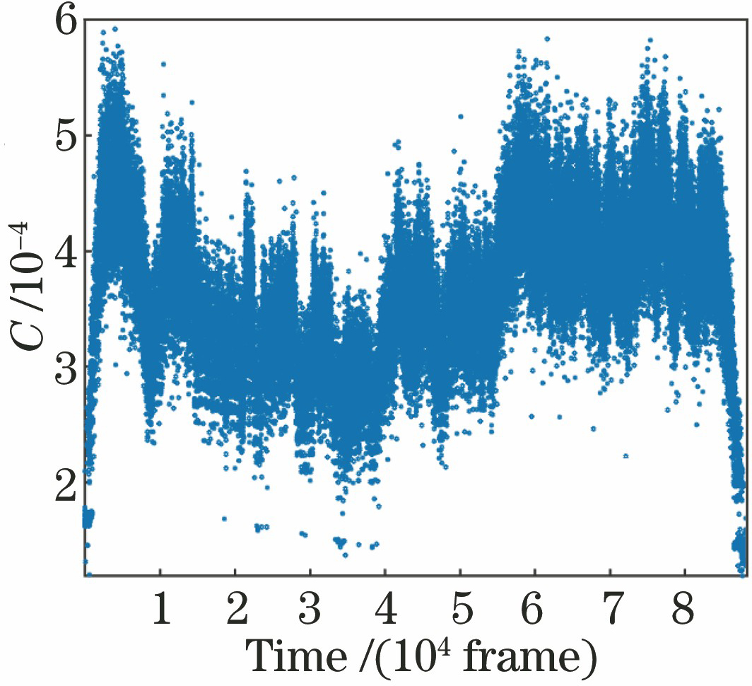
    Fig. 2. Relationship between coefficient C of detector 3 in an orbit and time when LOLA is in the moon's daytime
    Schematic of overlapping area between laser spot on lunar's surface and FOV of detector
    Fig. 3. Schematic of overlapping area between laser spot on lunar's surface and FOV of detector
    Relationship between relative energy received by detector and offset distance
    Fig. 4. Relationship between relative energy received by detector and offset distance
    Flow chart of estimating laser pointing error
    Fig. 5. Flow chart of estimating laser pointing error
    Introduction to Aestuum area. (a) Location of Aestuum area on map; (b) optical image of Aestuum area
    Fig. 6. Introduction to Aestuum area. (a) Location of Aestuum area on map; (b) optical image of Aestuum area
    All tracks during process of surveying. (a) Distance between spot 2 and actual receiving FOV 3; (b) distance between spot 5 and actual receiving FOV 4
    Fig. 7. All tracks during process of surveying. (a) Distance between spot 2 and actual receiving FOV 3; (b) distance between spot 5 and actual receiving FOV 4
    Method of laser pointing error estimation based on distance from spot to actual receiving FOV
    Fig. 8. Method of laser pointing error estimation based on distance from spot to actual receiving FOV
    All tracks in same night. (a) Distance between spot 2 and actual receiving FOV 3; (b) distance between spot 5 and actual receiving FOV 4
    Fig. 9. All tracks in same night. (a) Distance between spot 2 and actual receiving FOV 3; (b) distance between spot 5 and actual receiving FOV 4
    InstructionDesignation
    Experiment datarecords (EDR)Raw, uncorrected lunar surface altimetry data, as well as packetfile creation time, mission phase, etc
    Reduced datarecords (RDR)Calibrated, geolocation data sets, data set is a combination ofspacecraft trajectory, attitude history and lunar positioning model to recordposition of each laser spot on lunar surface
    Radiometry datarecords (RADR)Mainly includes reflectivity of lunarsurface along orbit direction
    Gridded datarecords (GDR)Mainly consists of grid digital elevation, includingsampling density, surface reflectance, slope, roughness,geoid height and surface reflectance at 1064 nm wavelength
    Spherical harmonicdata records (SHADR)Includes spherical harmonic topography and gravity potential modelsbased on LOLA rangefinder and radio tracking
    Table 1. Main data products of LOLA
    ValueDistance from center ofspot 2 to center oftheoretical FOV 3 /mDistance from center ofspot 5 to center oftheoretical FOV 4 /mOffset ofalong orbitdirection /μradOffset ofvertical orbitdirection /μrad
    Max value290.65285.7592.89272.81
    Min value175.46174.9556.47165.85
    Mean value264.16259.4784.38247.83
    Standard deviation11.3112.58
    Table 2. Offsets of two spots
    Yue Han, Song Li, Shizhe Yu, Zhiyu Zhang, Hui Zhou. Laser Pointing Error Estimation Based on Energy Data of LOLA System[J]. Acta Optica Sinica, 2020, 40(5): 0528001
    Download Citation