• Journal of Geo-information Science
  • Vol. 22, Issue 5, 989 (2020)
Licong LIAN1、1, Zhiwei WAN1、1、*, Min JU1、1, Yulian JIA1、1, Yijun HONG2、2, Meixin JIANG1、1, and Fenghai ZENG1、1
Author Affiliations
  • 1.江西师范大学地理与环境学院 鄱阳湖湿地与流域研究教育部重点实验室,南昌 330022
  • 1Key Laboratory of Poyang Lake Wetland and Watershed Research, Ministry of Education, School of Geography and Environment, Jiangxi Normal University, Nanchang 330022, China
  • 2.中国科学院地理科学与资源研究所 陆地表层格局与模拟院重点实验室,北京 100101
  • 2Key Laboratory of Land Surface Pattern and Simulation, Institute of Geographic Sciences and Natural Resources Research, Chinese Academy of Sciences, Beijing 100101, China
  • show less
    DOI: 10.12082/dqxxkx.2020.190548 Cite this Article
    Licong LIAN, Zhiwei WAN, Min JU, Yulian JIA, Yijun HONG, Meixin JIANG, Fenghai ZENG. Reconstruction of the Cropland Area and Its Spatial Distribution Pattern at Dongting Lake District of Hunan Province in the Middle of the Republic of China[J]. Journal of Geo-information Science, 2020, 22(5): 989 Copy Citation Text show less
    Geographical range and topographic map of research area
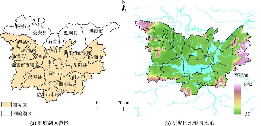
    Fig. 1. Geographical range and topographic map of research area
    Examples of the measured map of the Dongting Lake District in the middle of the Republic of China
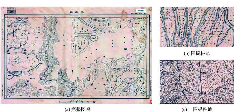
    Fig. 2. Examples of the measured map of the Dongting Lake District in the middle of the Republic of China
    Topographic map processing and cropland reconstruction flowchart
    Fig. 3. Topographic map processing and cropland reconstruction flowchart
    The spatial distribution of cropland in the Dongting Lake area during the period of the Republic of China
    Fig. 4. The spatial distribution of cropland in the Dongting Lake area during the period of the Republic of China
    The spatial distribution of cropland in the Dongting Lake area during the Republic of China
    Fig. 5. The spatial distribution of cropland in the Dongting Lake area during the Republic of China
    The 10 km×10 km reclamation rate spatial distribution pattern in the Dongting Lake area during the Republic of China
    Fig. 6. The 10 km×10 km reclamation rate spatial distribution pattern in the Dongting Lake area during the Republic of China
    Comparison of cropland reconstruction results in spatial resolution of 10 km×10 km in the Dongting Lake area of the Republic of China
    Fig. 7. Comparison of cropland reconstruction results in spatial resolution of 10 km×10 km in the Dongting Lake area of the Republic of China
    Licong LIAN, Zhiwei WAN, Min JU, Yulian JIA, Yijun HONG, Meixin JIANG, Fenghai ZENG. Reconstruction of the Cropland Area and Its Spatial Distribution Pattern at Dongting Lake District of Hunan Province in the Middle of the Republic of China[J]. Journal of Geo-information Science, 2020, 22(5): 989
    Download Citation