
Zui HU, Hui WANG. MCES-CA based Urban Expansion Simulation of Hengyang City [J]. Journal of Geo-information Science, 2020, 22(3): 616
- Journal of Geo-information Science
- Vol. 22, Issue 3, 616 (2020)
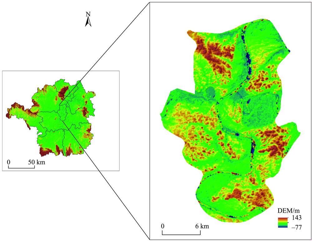
Fig. 1. Location of Downtown Hengyang City
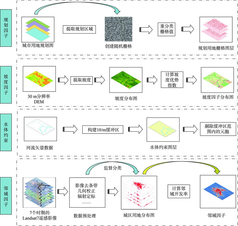
Fig. 2. Flowchart of data processing
Fig. 3. Conceptual framework of Geo-CA
Fig. 4. Modeling flowchart for CA
Fig. 5. Modeling flowchart for MCES-CA
Fig. 6. Development rate of CA cell's neighbors
Fig. 7. Distribution map of the slope pattern
Fig. 8. Simulation results versus actual historical land uses in 2002, 2003, 2004, 2006, 2011 and 2017
Fig. 9. Expanding-process maps of Hengyang City for 2001 to 2017
Fig. 10. Quantitative features of the urban expansion of Downtown Hengyang City
|
Table 1. ADT descriptions for MCES-CA
|
Table 2. Appropriate slopes for different urban uses
|
Table 3. Slope Advantage Index for main urban area of Hengyang City
|
Table 4. Urban areas of Downtown Hengyang from 2001 to 2017

Set citation alerts for the article
Please enter your email address
© Copyright 2018-2021 | Chinese Laser Press. All Rights Reserved 沪ICP备15018463号-20