
Yongquan WANG, Chisheng WANG, Lehan WANG, Jiani SHE, Qingquan LI. Preliminary Application of Night Light Remote Sensing based on Passenger Aircraft in Hong Kong Economic Activity Zone Changes Identification [J]. Journal of Geo-information Science, 2020, 22(5): 1153
- Journal of Geo-information Science
- Vol. 22, Issue 5, 1153 (2020)
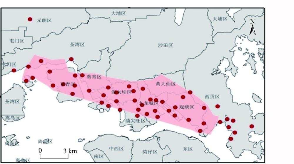
Fig. 1. Areaof image coveraged and ground control point distribution
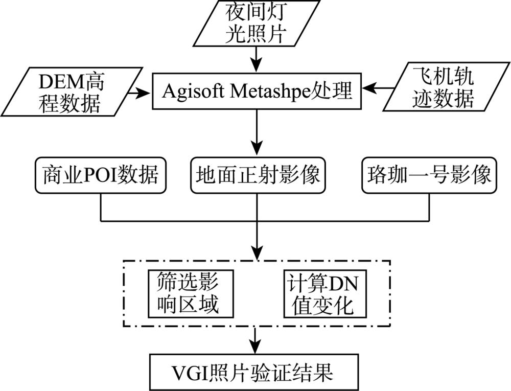
Fig. 2. Flow chart of economic activity change area detection
Fig. 3. Flight path interpolation results
Fig. 4. Comparison of smartphone light photos with ground control points in Google Earth
Fig. 5. POI density map of the study area in September, 2019
Fig. 6. Passenger aircraft night light remote sensing image of the study area in August 28, 2019
Fig. 7. Lujia-01 night light remote sensing image of the study area
Fig. 8. VGI photos before and after the demonstration
|
Table 1. The DN values and the percentage change ratios of the POIs in area 1 and area 2


Set citation alerts for the article
Please enter your email address

© Copyright 2018-2021 | Chinese Laser Press. All Rights Reserved 沪ICP备15018463号-20