Meijiao LI1,1,1,1,1,1,1,1,1,1,1,1,1,1,1,1,1,1, Fanneng HE1,1,1,1,1,1, Fan YANG1,1,1,1,1,1,1,1,1,1,1,1, and Liang ZHAO1,1,1,1,1,1,1,1,1,1,1,1
Author Affiliations
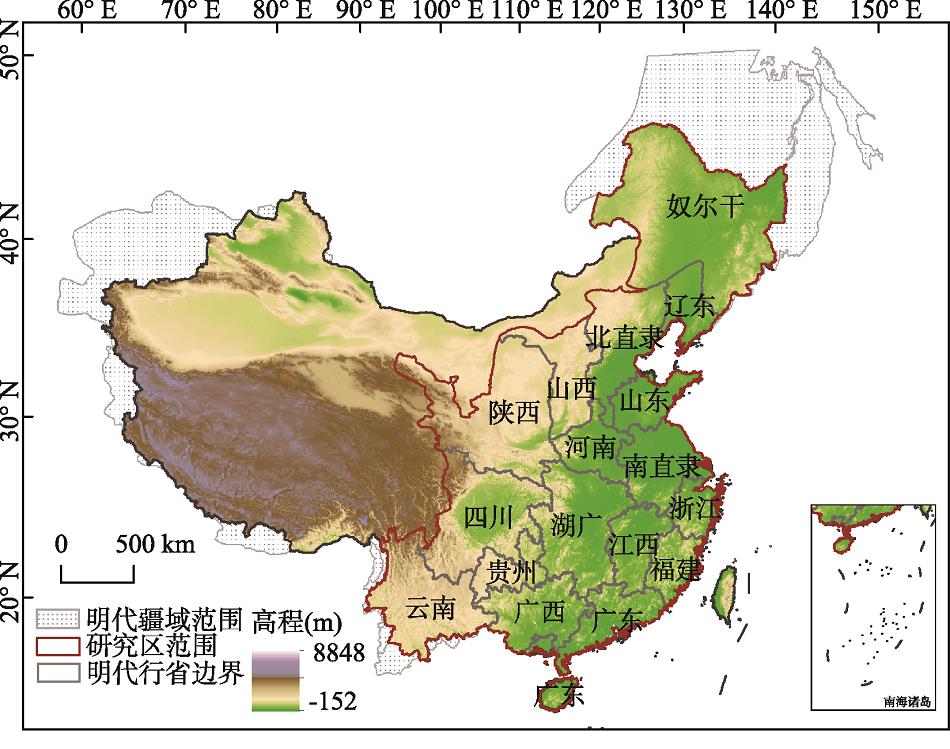
11Key Laboratory of Land Surface Pattern and Simulation, Institute of Geographic Sciences and Natural Resources Research, CAS, Beijing 100101, China11中国科学院地理科学与资源研究所 中国科学院陆地表层格局与模拟重点实验室,北京 10010112Shanxi University of Finance and Economics, College of Resources and Environment, Taiyuan 030006, China12山西财经大学资源环境学院,太原 03000613University of Chinese Academy of Sciences, Beijing 100049, China13中国科学院大学,北京 100049show less
Abstract
Based on the historical registered data on taxes-cropland and military-oriented cropland, population data, and the historical records on taxation system and land system in the Ming Dynasty, this paper analyzed the reliability of these data, and identified the main impact factors which may lead to the difference between historical registered data and real cropland area. Then, the provincial cropland areas for 1393 and 1583 were reconstructed. The results are shown as follows: (1) The main factors which lead to the difference between historical registered data and real cropland area include record errors, classified statistics of taxes-cropland and military-oriented cropland, and registration and taxation of non-cropland, including mountain, pond, lake, and marsh. (2) Because of the record errors, the registered taxes-cropland areas of Henan and Huguang provinces for 1393 were greater than their actual taxes-cropland areas. And the revised results of the two provinces were 0.41×10 6 mu (Chinese area unit, 1 mu=666.7 m 2) and 0.18×10 6 mu. The total military-oriented cropland area of the study area was 56.2×10 6 mu in 1393. (3) According to the historical records, in 1391, the proportion values of non-cropland data to the total taxes-cropland data were 24.7%, 23.3%, 4.4%, and 3.7% in Zhejiang, South Zhili, Jiangxi, and Huguang provinces, respectively. And in 1583, the proportion values of non-cropland data to the total areas of taxes-cropland and military-oriented cropland in the four provinces were 28.9%, 16.2%, 19.2%, and 11.6%, respectively. (4) The total cropland area of the whole study area increased from 495.5×10 6 mu in 1393 to 754.3×10 6 mu in 1583. In the study period, changes of the reclamation rate presented obvious regional differences. The reclamation rates of Henan and Shandong provinces increased by roughly 15 percentage points, Huguang and Sichuan provinces increased by more than 3 percentage points, and Zhejiang, Jiangxi, Fujian, and border areas increased by less than 1 percentage point. Reconstruction of historical land use and cover change at regional level is not only an objective requirement for regional eco-environmental effects simulation, which can provide a reference for enriching and improving global datasets.