Zhang LIU1,1,2,2, Jiale QIAN1,1,2,2, Yunyan DU1,1,2,2,*, Nan WANG1,1,2,2..., Jiawei YI1,1,2,2, Yeran SUN3,3,4,4, Ting MA1,1,2,2, Tao PEI1,1,2,2 and Chenghu ZHOU1,1,2,2|Show fewer author(s)
Author Affiliations
1State Key Laboratory of Resources and Environmental Information System, Institute of Geographic Sciences and Natural Resources Research, Chinese Academy of Sciences, Beijing 100101, China1中国科学院地理科学与资源研究所 资源与环境信息系统国家重点实验室,北京 1001012University of Chinese Academy of Sciences, Beijing 100049, China2中国科学院大学,北京 1000493School of Geography and Planning, Sun Yat-sen University, Guangzhou 510275, China3中山大学地理科学与规划学院,广州 5102754Department of Geography, Swansea University, Swansea SA28PP, United Kingdom4斯旺西大学地理系,斯旺西 SA28PP, 英国show less
DOI: 10.12082/dqxxkx.2020.200045
Cite this Article
Zhang LIU, Jiale QIAN, Yunyan DU, Nan WANG, Jiawei YI, Yeran SUN, Ting MA, Tao PEI, Chenghu ZHOU. Multi-level Spatial Distribution Estimation Model of the Inter-regional Migrant Population Using Multi-source Spatio-temporal Big Data: A Case Study of Migrants from Wuhan during the Spread of COVID-19[J]. Journal of Geo-information Science, 2020, 22(2): 147
Copy Citation Text
show less
Abstract
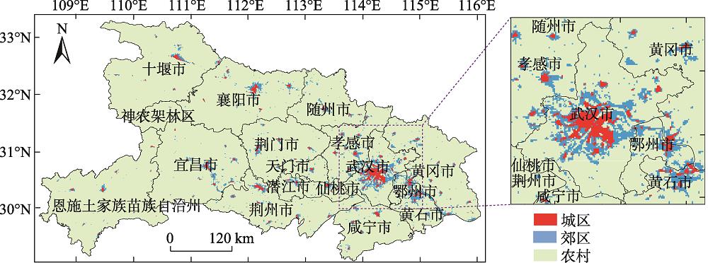
Previous researches have paid little attention to the multi-level spatial distribution dynamic estimation of the inter-regional migrant population. Preventing the spread of COVID-19 is the most urgent need for society now. Before the closure of Wuhan on Jan 23, 2020, more than 5 million people had left Wuhan to other regions. A better understanding of the destinations of those people will assist in the decision making and prevention of the coronavirus spread. However, few studies have focused on the dynamic estimation of multi-level spatial distribution of inter-regional migrant populations. In this study, by using multi-source spatiotemporal big data, including Tencent location request data, Baidu migration data, and land cover data, we proposed a dynamic estimation model of multi-level spatial distribution of inter-regional migrant population, and further characterized the spatial distribution of the population migrating from Wuhan to other regions of Hubei Province. The results showed that: (1) During the Spring Festival, the average ratio between the number of population increase in the rural areas and the total population change was 124.7% in the prefecture-level cities in Hubei Province. At least 51.3% of the population moving from Wuhan to prefecture-level cities has flowed into rural areas; (2) the spatial distribution of migrants among cities and counties in Hubei Province exhibits a 3-ring structure. The 1st ring is core area of disease, ncludes Wuhan and its surrounding areas, which are mainly characterized by population outflows. The 2nd ring is primary focus area, includes Huanggang, Huangshi, Xiantao, Tianmen, Qianjiang, Suizhou, Xiangyang and parts of Xiaogan, Jingzhou, Jingmen, Xianning, where the total population and the population in rural areas increased significantly during the Spring Festival. The 3rd ring is the secondary focus area, includes Yichang, Enshi, Shennongjia, and parts of Jingzhou and Jingmen, which are located in the western part of Hubei Province and are mainly characterized by a small inflow of population. We suggest higher attention to those rural areas of the counties located in the 2nd ring to better control and prevent the coronavirus spread. The research was completed in 2-3 days, showing that big data can quickly respond to major public safety events and provide support for decision-making.