
Zhifeng WU, Jiancheng LUO, Yingwei SUN, Tianjun WU, Zheng CAO, Wei LIU, Yingpin YANG, Lingyu WANG. Research on Precision Agricultural based on the Spatial-temporal Remote Sensing Collaboration [J]. Journal of Geo-information Science, 2020, 22(4): 731
- Journal of Geo-information Science
- Vol. 22, Issue 4, 731 (2020)
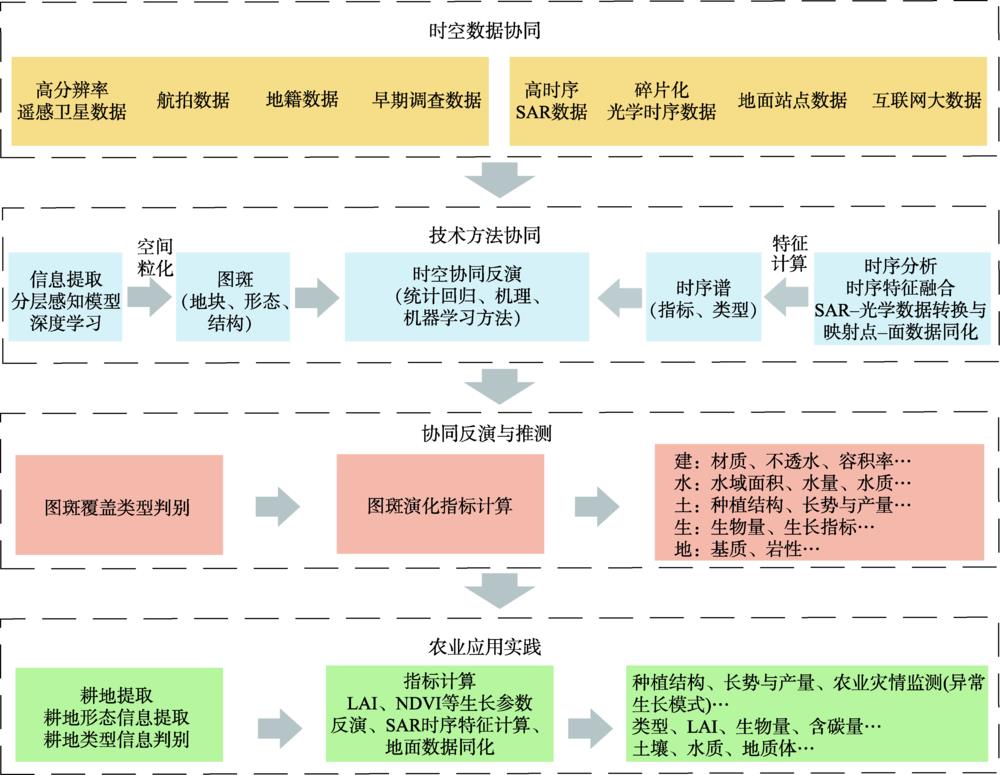
Fig. 1. Space-spatial cooperation research framework of remote sensing
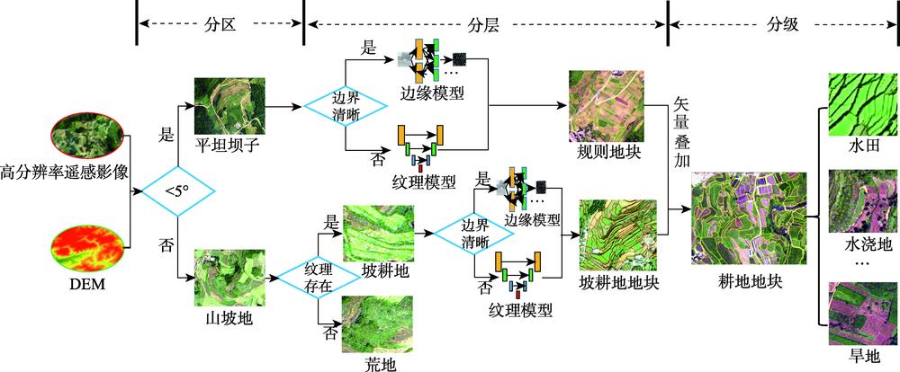
Fig. 2. Schematic diagram division control and stratified extraction workflow of mountain area
Fig. 3. Remote sensing image and diagram of typical geo-parcel
Fig. 4. Geo-parcel spatial distribution map in Xixiu District and Quli Town
Fig. 5. Geo-parcel results of the proposed method and the multi-segment method
Fig. 6. Crop physical and chemical parameters inversion at geo-parcel scale
Fig. 7. Curve diagram of sugarcane plot and NDVI in Dubang Village, Fusui County
Fig. 8. Dynamic LAI changes of sugarcane plot in Dubang Village, Fusui County
|
Table 1. input parameters for PROSAIL model


Set citation alerts for the article
Please enter your email address

© Copyright 2018-2021 | Chinese Laser Press. All Rights Reserved 沪ICP备15018463号-20