• Journal of Geo-information Science
  • Vol. 22, Issue 3, 474 (2020)
Haifeng GAO1、1, Ying GE1、1、*, Jie ZHANG2、2, Shengchang XIAO2、2, and Ke CHEN2、2
Author Affiliations
  • 1School of Earth Sciences and Engineering, Hohai University, Nanjing 211100, China
  • 1河海大学地球科学与工程学院,南京 211100
  • 2Hydrochina Kunming Engineering Corporation LTD, Kunming 650051, China
  • 2中国电建集团昆明勘测设计研究院有限公司,昆明 650051
  • show less
    DOI: 10.12082/dqxxkx.2020.190381 Cite this Article
    Haifeng GAO, Ying GE, Jie ZHANG, Shengchang XIAO, Ke CHEN. K-means Classifier for Automatic Slope Position Detection in Mountainous Areas[J]. Journal of Geo-information Science, 2020, 22(3): 474 Copy Citation Text show less
    DEM of Yao'an County, Yunnan Province
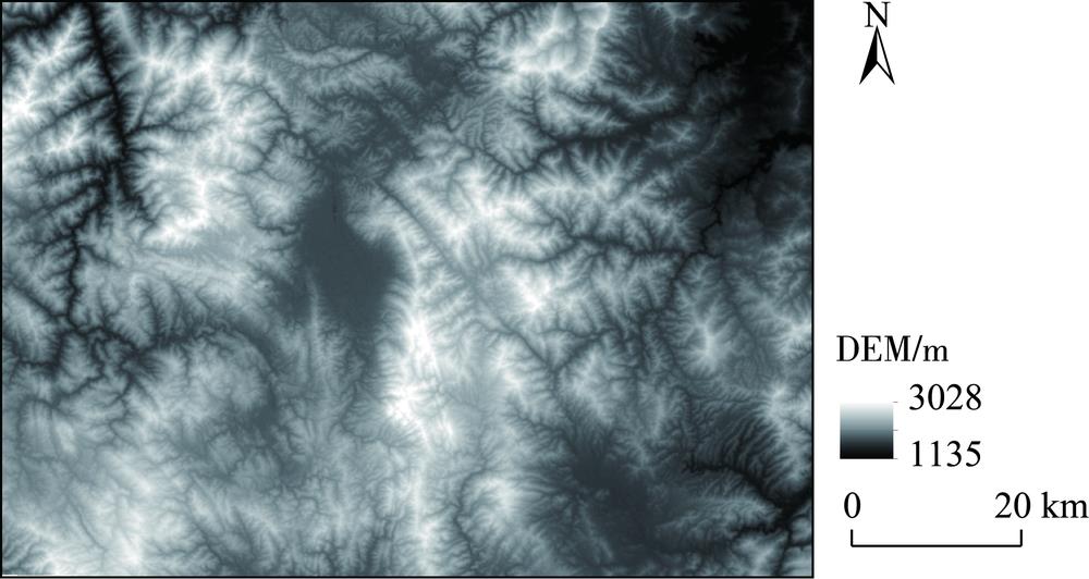
    Fig. 1. DEM of Yao'an County, Yunnan Province
    Map of peak area in the study area
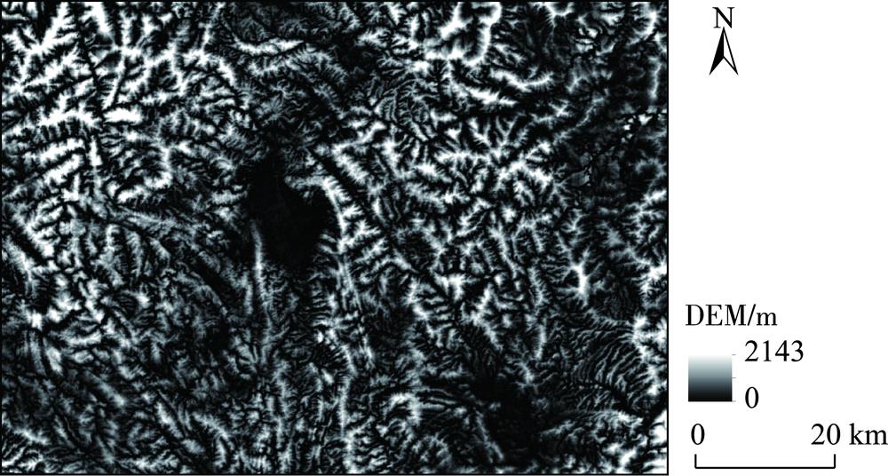
    Fig. 2. Map of peak area in the study area
    s(k)value varies with clustering number k
    Fig. 3. s(k)value varies with clustering number k
    SSE calculated by the two methods varies with clustering number k
    Fig. 4. SSE calculated by the two methods varies with clustering number k
    ARI calculated by the two methods varies with clustering number k
    Fig. 5. ARI calculated by the two methods varies with clustering number k
    s(k) value varies with iterations based on a clustering number k
    Fig. 6. s(k) value varies with iterations based on a clustering number k
    Map of slope position automatic classification
    Fig. 7. Map of slope position automatic classification
    Overlay map of slope position distribution and topographic contour
    Fig. 8. Overlay map of slope position distribution and topographic contour
    Overlay map of slope position distribution and planned wind farms in Yao'an County
    Fig. 9. Overlay map of slope position distribution and planned wind farms in Yao'an County
    Slope position distribution of wind farm 6 based on different suitable windows
    Fig. 10. Slope position distribution of wind farm 6 based on different suitable windows
    风电场适宜窗口沟谷坡脚背坡坡肩山脊总计
    格点数占比格点数占比格点数占比格点数占比格点数占比格点数占比
    313×13553142.84367428.45265220.5410257.94300.2312 912100
    25×25386429.93391630.33355627.54149411.57820.6412 912100
    37×37335025.94430033.30410231.7711108.60500.3919 635100
    413×13792540.36619331.54411020.9313837.04240.1219 635100
    25×25575829.33685634.92549327.9814997.63290.1519 635100
    37×37568428.95758738.64554328.238214.1800.0022 841100
    913×13851837.29551824.16470320.59339614.877063.0922 841100
    25×25491421.51487921.36563524.67589925.8315146.6322 841100
    37×37383916.81486421.30649628.44676029.608823.8622 841100
    Table 1. [in Chinese]
    Haifeng GAO, Ying GE, Jie ZHANG, Shengchang XIAO, Ke CHEN. K-means Classifier for Automatic Slope Position Detection in Mountainous Areas[J]. Journal of Geo-information Science, 2020, 22(3): 474
    Download Citation