
Mingyang CHENG, Linna LI, Yang ZHOU. Exploring the urban-rural development differences and influencing factors in the Huang-Huai-Hai Plain of China[J]. Journal of Geographical Sciences, 2020, 30(10): 1603
- Journal of Geographical Sciences
- Vol. 30, Issue 10, 1603 (2020)
Abstract
Keywords
1 Introduction
China has implemented a strict urban and rural household registration system since the founding of the People’s Republic of China in 1949. With the implementation of the reform and opening policy in 1978, China's urban and rural household registration system was gradually broken, but the urban-rural dual track system still has a profound impact on China's economy and society (
The HHHP (also called the North China Plain), which is one of the country’s main grain-producing areas, is facing serious problems of rural decline, marginalization of agriculture, weakening of the population, hollowing of villages and environmental pollution. The development model of rural areas supporting cities and agriculture supporting industries has made rural areas unsustainable and aggravated the urban-rural development gap (
Urban-rural relationships include the fundamental economic and social relationships of an area (
An urban-rural regional system is a comprehensive system composed of different subsystems. Urban-rural disparity is an important part of urban-rural relationships. The incoordination between urban and rural areas affects regional sustainable development and exacerbates the decline of rural areas. The question of how to measure the differences between urban and rural areas from a comprehensive perspective remains many challenges. Therefore, the main aims of this study are to establish the index system and model of urban-rural development differences, and identify the leading factors affecting the urban-rural development differences. This study provides a new and appropriate concept for understanding urban-rural integrated development and rural revitalization.
![]()
Figure 1.
2 Materials and methods
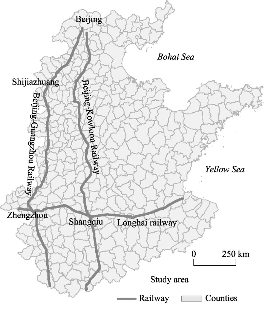
2.1 Study area
The HHHP (32°-40°N, 114°-121°E) is one of the largest grain-producing areas in China. The plain spans seven provinces and cities, including Beijing, Tianjin, Hebei, Shandong, Henan, Anhui and Jiangsu, covering an area of about 0.30 million km2 (
2.2 Data and methods
The imbalance between urban and rural development in the HHHP is one of the main driving forces of rural decline. The URDI is a feasible method to measure the development gap between urban and rural areas. Population, land and industry (PLI) are the core elements of the urban-rural system. People is the main body of the system, and their behavior can promote or slow down urban-rural development. Land is the basic element of production and provides a space carrier for development, and industry is the core driving force behind regional economic development. Thus, this study used these three indicators of population, land and industry to analyze the URDI. We constructed an evaluation model for the urban-rural difference based on the concept of Euclidean distance (Equation 1). In this study, the values of the URDI range from 0 to 3. The greater the difference between urban and rural areas is, the greater the URDI is. URDI=0 implies no obvious urban-rural development difference, whereas URDI=3 indicates the existence of a clear difference.
where
The indicators for measuring the URDI include multiple sub-indicators. Urban population (UP) includes the proportion of workers to the total urban population in secondary and tertiary industries and the disposable income of urban residents. Urban land (UL) includes the intensive level of land use in urban built-up areas and the secondary and tertiary industrial output value per km2 in the urban built-up areas. Urban industry (UI) includes the urban per capita output value of secondary and tertiary industries. Rural population (RP) includes the proportion of rural workers to the total rural population and the disposable income of rural residents. Rural land (RL) includes the intensive level of land use in rural settlements and the grain output value per km2 of cultivated land; the grain output value was calculated using the grain price of 2015. Rural industry (RI) includes the rural per capita output value of primary industry. These social and economic data were obtained from the Statistical Yearbook of China’s Counties (
where${{{X}'}_{i}}^{{}}$is the value of the normalized index variable;
In general, the level of road network coverage, as well as natural, economic and social factors, are the factors influencing the development of urban and rural areas. The four indicators include different sub-indicators (
where
| Destination layer | Criteria layer | Index layer | Weights |
|---|---|---|---|
| Urban | Urban population | Proportion of workers to the total urban population in secondary and tertiary industries | 0.50 |
| Disposable income of urban residents | 0.50 | ||
| Urban land | Intensive level of land use in urban built-up areas (person/km2) | 0.51 | |
| Secondary and tertiary industrial output value per km2 in urban built-up areas | 0.49 | ||
| Urban industry | Urban per capita output value of secondary and tertiary industries (yuan per capita) | 1.00 | |
| Rural | Rural population | Proportion of rural workers to the total rural population | 0.50 |
| Disposable income of rural residents | 0.50 | ||
| Rural land | Intensive level of land use in rural settlements (person/km2) | 0.51 | |
| Grain output value per km2 of cultivated land | 0.49 | ||
| Rural industry | Output value per capita of rural primary industry | 1.00 |
Table 1.
Indicators of the urban-rural difference index
| Factors | Index layer | Weights |
|---|---|---|
| Road network | Highway length per km2 | 0.20 |
| National road length per km2 | 0.26 | |
| Provincial road length per km2 | 0.23 | |
| County road length per km2 | 0.28 | |
| Railway length per km2 | 0.13 | |
| Natural factors | County average slope | |
| Economic factors | County per capita GDP | 0.40 |
| County per capita public finance income | 0.30 | |
| County per capita taxes | 0.30 | |
| Social factors | County per capita social welfare homes | 0.31 |
| County per capita medical and health beds | 0.36 | |
| Proportion of students to the county population | 0.33 |
Table 2.
Indicators of the factors influencing urban-rural development
3 Results
3.1 Spatial pattern of the urban-rural difference index
The mean value of the URDI in the HHHP was 0.295, which shows that there is a low level of urban-rural differences. The URDI was relatively high in the western counties of the HHHP along the Beijing-Guangzhou Railway. In this area, the values of most counties’ URDIs were greater than 0.350, while some even exceeded 0.410. In contrast, the URDIs of the middle area along the Beijing-Kowloon Railway were lower than those of the west. Most of the URDI values were below 0.340. Although the URDI values of some counties were high, such as the coastal areas of Tangshan City, the counties in Dongying City, most of the counties in the economic circle around the Bohai Sea were relatively low. On the whole, the URDI values in the western part of the HHHP were higher than those in the eastern (
![]()
Figure 2.
Different types of PLI are shown in
| Urban-rural population | Urban-rural land | Urban-rural industry | Development level | |||
|---|---|---|---|---|---|---|
| UP | RP | UL | RL | UI | RI | |
| [0, 0.3] | [0, 0.3] | [0, 0.3] | [0, 0.3] | [0, 0.3] | [0, 0.3] | Low |
| (0.3, 0.6] | (0.3, 0.6] | (0.3, 0.6] | (0.3, 0.6] | (0.3, 0.6] | (0.3, 0.6] | Medium |
| (0.6, 1] | (0.6, 1] | (0.6, 1] | (0.6, 1] | (0.6, 1] | (0.6, 1] | High |
Table 3.
Grading standards for urban-rural development
The UP and RP were all low or medium in most parts of the HHHP, and spatial differentiation was obvious. The proportions of low-level and medium-level urban-rural population were 9.33% and 49.67%, respectively. In contrast, the proportion of low-level UP and medium-level RP was 28.67% (
| Development type | Urban-rural | Urban-rural | Urban-rural |
|---|---|---|---|
| Low-level urban-rural development | 9.33 (28) | 13.33 (40) | 83.67 (251) |
| Low-level urban development and medium-level rural development | 28.67 (86) | 48.00 (144) | 6.00 (18) |
| Low-level urban development and high-level rural development | 0.33 (1) | 7.33 (22) | 0.33 (1) |
| Medium-level urban development and low-level rural development | 5.00 (15) | 6.33 (19) | 7.00 (21) |
| Medium-level urban-rural development | 49.67 (149) | 18.00 (54) | 1.33 (4) |
| Medium-level urban development and high-level rural development | 6.33 (19) | 4.33 (13) | 0.67 (2) |
| High-level urban development and low-level rural development | 0 | 1.00 (3) | 1.00 (3) |
| High-level urban development and medium-level rural development | 0.33 (1) | 1.67 (5) | 0 |
| High-level urban-rural development | 0.33 (1) | 0 | 0 |
Table 4.
Proportion of different types of urban-rural population-land-industry in the Huang-Huai-Hai Plain in 2015
![]()
Figure 3.
Compared with the spatial pattern of urban-rural population, the spatial differentiation of urban-rural land was not obvious. The medium and low levels of RL and UL were the main types. The proportions of low-level UL and RL, low-level UL and medium-level RL were 13.33% and 48.00%, respectively. Meanwhile, the proportion of medium-level UL and RL was 18.00% (
Similar to urban-rural population development, the spatial differentiation of urban-rural industry was also obvious. The overall level of urban-rural industrial development was low. The proportion of low-level UI and RI was 83.67% of the total. Although urban-rural industrial development was low, urban industrial development was greater than its rural counterpart in the HHHP. The differences in the urban-rural industrial development of some counties in the economic circle around the Bohai Sea presented medium-level UI and low-level RI types, as for some counties in Jiangsu Province in the HHHP (
3.2 Factors influencing the urban-rural difference index
From the development of the four factors including the road network coverage level as well as natural, economic and social factors, we can see that each factor presented different spatial patterns (
In general, the HHHP has relatively flat terrain, with an average slope below 0.251 in most of this area. In the western part of the plain, the terrain is steeper and its altitude is higher than other parts, as is the area around Shandong. The spatial pattern of economic development in counties was obvious in the HHHP. Economic development in the eastern counties was higher than that in the west. This is also consistent with the decline in China’s economic development from the east coast to the central and western parts of the country. The central region showed a typical low-value area of economic development, while the level of development in both eastern and western parts of the area was high. The high-value areas formed an L-shaped spatial pattern for social development. From Baoding to the northern part of Zhengzhou, the extension of the Beijing-Guangzhou Railway has formed a high-development-level axis of social factors, as has the extension of the Longhai Railway from Jiaozuo to Lianyungang. The index of social factors in the economic circle around the Bohai Sea was also high.
In order to explore the factors affecting the URDI, we used geographically weighted regression to analyze the road network coverage level, as well as natural, economic and social factors. By using the Akaike information criterion (AIC) method, the optimal bandwidth was
![]()
Figure 4.
208151.72 m. The results show that AIC was -378.62 and the
![]()
Figure 5.
In general, the road network coverage level has a positive effect on the regional URDI of western counties and a negative effect on eastern counties, although there are fewer of the latter. That is to say, the greater the density of the road network is, the greater the URDI is in the western part of the HHHP. The regression coefficients reflect that the degree of influence declines from west to east. In the western part of the HHHP along the foothills of the Taihang Mountains, the positive influence of traffic factors on the URDI is large over the whole area. The absolute values of the negative regression coefficients in the economic circle around the Bohai Sea are also large, and all they are greater than 0.234.
The degree of the average slope has a negative effective on the URDI in the HHHP. This means that the greater the average slope is, the smaller the URDI is. The areas with strong influence are mainly in the western part of Henan and Hebei provinces and the southeast part of the HHHP. The impact of slope on the URDI is small in the economic circle around the Bohai Sea. Overall, the regression coefficients of the average slope are lower than other factors, and their absolute values are less than 0.201.
Economic factors have a positive effect on the URDI, which shows that economic development has exacerbated the difference between urban and rural areas in the HHHP. The influence of economic factors gradually decreases from the south and east to the north and west. The counties with a high positive influence are distributed mainly in the eastern and southwestern parts of the HHHP. Economic factors in some counties of Hebei Province have a negative impact on the URDI, but the absolute values of the regression coefficients are very small. In general, the greater the index of economic factors is, the larger the URDI is.
Although social factors have a negative effect on the URDI in most of the HHHP, they have a positive effect on the URDI in counties that surround cities along the Longhai Railway, such as Zhengzhou, Shangqiu and Xuzhou. However, the regression coefficients of their positive influence are relatively small. This shows that the development of social factors can reduce the URDI, and negative impacts in many counties are obvious (the absolute value of the regression coefficient is large). Therefore, the allocation of social infrastructure can effectively narrow the gap between urban and rural areas.
4 Discussion
Previous studies have focused on a single aspect of urban-rural differences, such as income inequality (
(1) Urban-rural PLI development is at a low level in the HHHP, which is the main reason for small URDIs in this area. The proportions of urban-rural population, land and industry both at high-level are only 0.33%, 0% and 0%, respectively. Urban-rural development is at a low level in most counties of the HHHP. The development of urban-rural population and industry is relatively low, which reflects that industrial development and job opportunities in the counties are relatively meagre. This is also one of the important reasons for “residential and industrial separation”, that is, the low level of industrial development has not brought sufficient jobs to local residents. Therefore, the habitants of the area are forced to leave home to work in other cities for higher payment. In addition, more attention should be paid to avoiding blind urban expansion.
(2) Natural factors have less influence on the URDI than other factors. The negative influence of the road network coverage level on the URDI in the economic circle around the Bohai Sea and the positive influence of economic factors are both considerable, while the negative influence of social factors is large, too. This means that this area has achieved better coordinated development between urban and rural areas in the development of society and road facilities. In the process of regional development, economic differences between urban and rural areas should be coordinated. The positive influence of economic and social factors on the URDI in Jiangsu Province is relatively large, whereas the negative influence of road coverage level is obvious. This reflects that the relationship between urban and rural areas has not been coordinated effectively in this region. That means that the overall development of urban and rural areas needs to be strengthened, especially economically and socially. For counties along the Beijing-Guangzhou Railway, the advantages of the transportation infrastructure should continue to be exploited. Meanwhile, attention should also be given to the allocation of social facilities in order to avoid the intensification of these differences.
(3) For most areas, the greater the road network coverage level is, the higher the URDI is.
(4) The better the development level of the county economy is, the greater the difference between urban and rural areas is. The town is the growth pole in rural areas around which the economy develops in China. According to growth pole theory, the development of the county economy extending from the urban center to the periphery is a universal phenomenon. In fact, the urban economy is often given priority for development. Under the traditional urban-rural dual track system, rural development is often neglected (
(5) The greater the development level of regional social factors is, the smaller the difference between urban and rural areas is.
5 Conclusions
This study built a quantitative model for measuring the urban-rural development gap from a comprehensive perspective, and analyzed the spatial pattern of the URDI in the HHHP in 2015 based on this, and identified the dominant factors affecting this gap. The results show that this index can reflect the differences in urban-rural development in the HHHP. In general, the URDI in the HHHP was low and its mean value was 0.295. A high value axis has been formed along the Beijing-Guangzhou Railway. The URDI in the western region of the HHHP was higher than that in the eastern area, indicating the existence of an obvious urban-rural development difference in the western region.
The low level of urban-rural PLI development in the HHHP was an important reason for the small differences between urban and rural areas. The proportions of urban-rural population, land and industry both at high-level are only 0.33%, 0% and 0%, respectively. There is a serious separation between rural housing and industry in the whole area. In the future, land use needs to be further developed more intensively. In the HHHP, only the economic circle around the Bohai Sea has achieved a balance between urban and rural areas in both transportation and social development.
The development of the transportation has led to an increase in differences between urban and rural areas. The development of road network has improved the conditions for development of the whole area. However, the rural areas cannot rely on the road network to obtain rapid development because of a lack of rural growth poles, which leads to widening of the URDI. Meanwhile, the role of economic agglomeration in the development of the county is still gaining strength. In the process of economic development, more attention should be paid to the development of the rural economy in the future in order to achieve rural revitalization. The equivalent allocation of social service facilities is an effective way to solve the problem of urban-rural development imbalance. In the HHHP, terrain factors have relatively little influence on the URDI.
References
[1] ChenC. Spatio-temporal pattern change and optimized approach of urban-rural equalized development in China. Beijing: University of Chinese Academy of Sciences(2015).
[2] Chen MX, Huang YB, Tang Z P et al. The provincial pattern of the relationship between urbanization and economic development in China. Journal of Geographical Sciences, 24, 33-45(2014).
[3] FangH, ChenJ, Rizzo JA. Explaining urban-rural health disparities in China. Medical Care, 47, 1209-1216(2009).
[4] Filani MO. Transport and rural development in Nigeria. Journal of Transport Geography, 1, 248-254(1993).
[5] Gren?, AnderssonE. Being efficient and green by rethinking the urban-rural divide: Combining urban expansion and food production by integrating an ecosystem service perspective into urban planning. Sustainable Cities and Society, 40, 75-82(2018).
[6] HaoL, HuA, LoJ. Two aspects of the rural-urban divide and educational stratification in China: A trajectory analysis. Comparative Education Review, 58, 509-536(2014).
[7] HaasT, WestlundH. In the Post-urban World: Emergent Transformation of Cities and Regions in the Innovative Global Economy(2018).
[8] Henderson JV, Wang HG. Aspects of the rural-urban transformation of countries. Journal of Economic Geography, 5, 23-42(2005).
[9] Li YH, Liu YS. Investigation of the resource & environment issues in the urban-rural transition in China. Economic Geography, 33, 61-65(2013).
[10] Li YR, Liu YS, Long HL. Study on the pattern and types of rural development in the Huang-Huai-Hai region. Geographical Research, 30, 1637-1647(2011).
[11] Liang XC, Ming XD, Ling ZX. Evaluation of urban-rural integration course in northeast China. Scientia Geographica Sinica, 24, 320-325(2004).
[12] Liu YS. Research on the urban-rural integration and rural revitalization in the new era in China. Acta Geographica Sinica, 73, 2-14(2018).
[13] Liu YS, Li YH. Revitalize the world’s countryside. Nature, 548, 275-277(2017).
[14] Liu YS, Li YR, Chen Y F et al. The process and driving forces of rural hollowing in China under rapid urbanization. Journal of Geographical Sciences, 20, 876-888(2010).
[15] Long HL, Liu YS, Li X B et al. Building new countryside in China: A geographical perspective. Land Use Policy, 27, 457-470(2010).
[16] MagnaniE, ZhuR. Gender wage differentials among rural-urban migrants in China. Regional Science & Urban Economics, 42, 779-793(2012).
[17] MakitaK, Fèvre EM, Waiswa C et al. Population-dynamics focussed rapid rural mapping and characterisation of the peri-urban interface of Kampala, Uganda. Land Use Policy, 27, 888-897(2010).
[18] . Statistical Yearbook of China’s Counties 2016.(2016).
[19] QianX, SmythR. Measuring regional inequality of education in China: Widening coast-inland gap or widening rural-urban gap?. Journal of International Development, 20, 132-144(2008).
[20] ShiY, GuoF, NipperJ. A comparative study on integration of urban and rural areas between the developed areas in China and Germany: A case study of Yangtze Delta and the lower reaches of Rhine. Human Geography, 19, 25-29(2004).
[21] Tam T JJ. Divergent urban-rural trends in college attendance: State policy bias and structural exclusion in China. Sociology of Education, 88, 160-180(2015).
[22] Xu HS, MaC, Lian J J et al. Urban flooding risk assessment based on an integrated k-means cluster algorithm and improved entropy weight method in the region of Haikou, China. Journal of Hydrology, 563, 975-986(2018).
[23] Yan JM, ChenH, Xia FZ. Toward improved land elements for urban-rural integration: A cell concept of an urban-rural mixed community. Habitat International, 77, 110-120(2018).
[24] Yang DT, ZhouH. Rural-urban disparity and sectoral labour allocation in China. Journal of Development Studies, 35, 105-133(1999).
[25] YangR. Spatial coupling cooperative analysis of road transport superiority and urbanization at county level in China. Progress in Geography, 35, 806-815(2016).
[26] YuW, JiangX. The third-type settlement: Research of unified urban and rural living organisms and its interaction design. In: Design, User Experience, and Usability: Novel User Experiences(2016).
[27] Zheng WZ, Zheng XB. The space-time evolutional pattern of core town’s function to the integration of urban and rural areas: Theory and evidence. Economic Geography, 33, 79-83(2013).
[28] ZhuY. Difference of urban-rural residents’ income and consumption in Chongqing City from 2000 to 2009. Journal of Anhui Agricultural Sciences, 39, 15104-15107(2011).


Set citation alerts for the article
Please enter your email address

© Copyright 2018-2021 | Chinese Laser Press. All Rights Reserved 沪ICP备15018463号-20