


Hongshu HE, Xiaoxia HUANG, Hongga LI, Lingjia NI, Xinge WANG, Chong CHEN, Ze LIU. Water Body Extraction of High Resolution Remote Sensing Image based on Improved U-Net Network [J]. Journal of Geo-information Science, 2020, 22(10): 2010
- Journal of Geo-information Science
- Vol. 22, Issue 10, 2010 (2020)
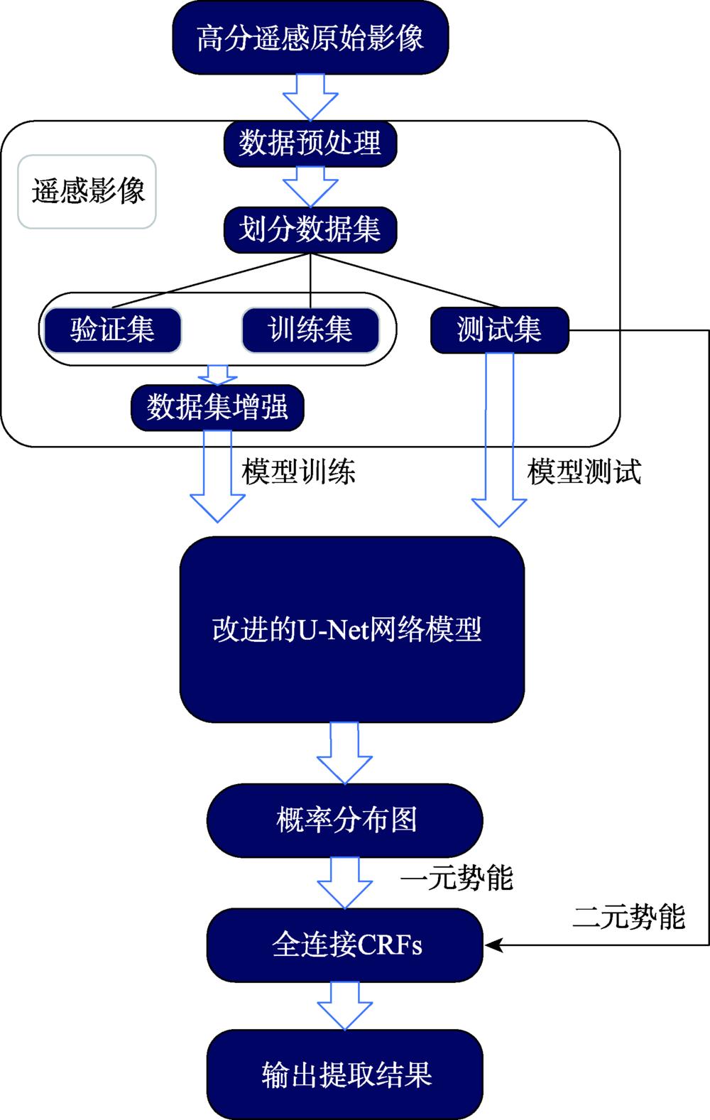
Fig. 1. Technical routes for extracting the water body
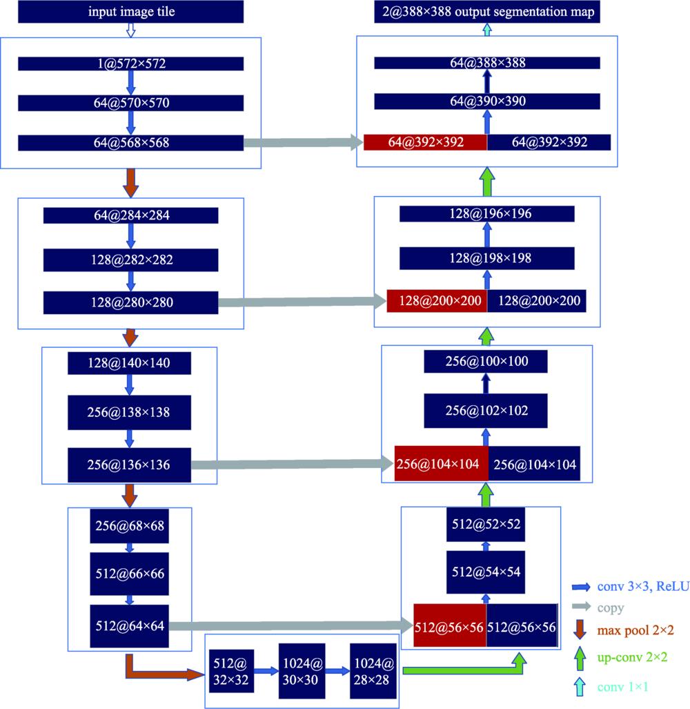
Fig. 2. U-Net architecture
Fig. 3. Improved U-Net network low-dimensional information enhancement
Fig. 4. Full connection condition random field post-processing model
Fig. 5. Location of Qingdao study area
Fig. 6. GF-2 image processing flowchart
Fig. 7. Training curve of improved U-Net
| ||||||||||||||||||||||||||||||||||||||||||||||||||||||||||||||||||||||||||||||||||||||||||||||||||||
Table 1. VGG16 network structure configuration
|
Table 2. RemotesensingimageinformationintheQingdaostudyarea
|
Table 3. Basic system platform configuration
|
Table 4. Important software configuration
|
Table 5. Comparison of water extraction results by different methods in 5 typical areas of the study area
|
Table 6. Confusion matrix for accuracy evaluation
|
Table 7. Accuracy comparison of water extraction results
|
Table 8. Remote sensing image information in the application area
|
Table 9. Comparison of water extraction results in 5 typical areas of the application area


Set citation alerts for the article
Please enter your email address

© Copyright 2018-2021 | Chinese Laser Press. All Rights Reserved 沪ICP备15018463号-20