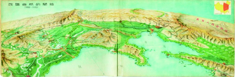
[1] 陈述彭. 中国地形鸟瞰图集[M]. 北京:中华书局, 1954. [ ChenS. Bird's-eye view atlas of terrain in China[M]. Beijing: Zhonghua Book Company, 1954. ] [ Chen S. Bird's-eye view atlas of terrain in China[M]. Beijing: Zhonghua Book Company, 1954. ]
[2] 陈述彭. 中国地形鸟瞰图集的编制工作[J]. 地理学报, 1955,21(1):71-86. [ ChenS. Compiling of "bird's-eye view atlas of terrain in China"[J]. Acta Geographica Sinica, 1955,21(1):71-86. ] [ Chen S. Compiling of "bird's-eye view atlas of terrain in China"[J]. Acta Geographica Sinica, 1955,21(1):71-86. ]
[3] et alTanDEM-X: A satellite formation for high-resolution SAR interferometry[J]. IEEE Transactions on Geoscience and Remote Sensing, 45, 3317-3341(2007).
[4] Earth Env-DEM 90: A nearly-global, void-free, multi-scale smoothed, 90 m digital elevation model from fused ASTER and SRTM data[J]. ISPRS Journal of Photogrammetry and Remote Sensing, 87, 57-67(2014).
[5] et alA high-accuracy map of global terrain elevations[J]. Geophysical Research Letters, 44, 5844-5853(2017).
[6] et alHigh-quality seamless DEM generation blending SRTM-1, ASTER GDEM v2 and ICESat/GLAS observations[J]. ISPRS Journal of Photogrammetry and Remote Sensing, 123, 20-34(2017).
[7] Terrain analysis: Principles and applications[M]. New York: Wiley(2000).
[8] 周启鸣, 刘学军. 数字地形分析[M]. 北京: 科学出版社, 2006. [ ZhouQ M, LiuX J. Digital terrain analysis[M]. Beijing: Science Press, 2006. ] [ Zhou Q M, Liu X J. Digital terrain analysis[M]. Beijing: Science Press, 2006. ]
[9] et alGeomorphometry: Concepts, software, applications[M]. Amsterdam: Elsevier(2009).
[10] 陈述彭, 鲁学军, 周成虎. 地理信息系统导论[M]. 北京: 科学出版社, 1999. [ ChenS, LuX, ZhouC. Introduction to geographical information system[M]. Beijing: Science Press, 1999. ] [ Chen S, Lu X, Zhou C. Introduction to geographical information system[M]. Beijing: Science Press, 1999. ]
[11] 王彦文, 秦承志. 地貌形态类型的自动分类方法综述[J]. 地理与地理信息科学, 2017,33(4):16-21. [ WangY, QinC. Review of methods for landform automatic classification[J]. Geography and Geo-information Science, 2017,33(4):16-21. ] [ Wang Y, Qin C. Review of methods for landform automatic classification[J]. Geography and Geo-information Science, 2017,33(4):16-21. ]
[12] 汤国安. 我国数字高程模型与数字地形分析研究进展[J]. 地理学报, 2014,69(9):1305-1325. [ TangG. Progress of DEM and digital terrain analysis in China[J]. Acta Geographica Sinica, 2014,69(9):1305-1325. ] [ Tang G. Progress of DEM and digital terrain analysis in China[J]. Acta Geographica Sinica, 2014,69(9):1305-1325. ]
[13] et alChinese progress in geomorphometry[J]. Journal of Geographical Sciences, 27, 1389-1412(2017).
[14] et alGeographic information system: Principles and applications[M]. New York: Longman Scientific & Technical(1991).
[15] et alGeographical information systems: Principles, techniques, management and applications (two volumes)[M]. New York: Wiley(1999).
[16] The recent advancement in digital terrain analysis and modeling[J]. International Journal of Geographical Information Science, 27, 1269-1271(2013).
[17] Digital terrain modeling[J]. Geomorphology, 137, 107-121(2012).
[18] An evaluation of void-filling interpolation methods for SRTM data[J]. International Journal of Geographical Information Science, 21, 983-1008(2007).
[19] Interpolating mean rainfall using thin plate smoothing splines[J]. International Journal of Geographical Information Systems, 9, 385-403(1995).
[20] ESP: A tool to estimate scale parameter for multiresolution image segmentation of remotely sensed data[J]. International Journal of Geographical Information Science, 24, 859-871(2010).
[21] 杨昕, 汤国安, 刘学军, 等. 数字地形分析的理论、方法与应用[J]. 地理学报, 2009,64(9):1058-1070. [ YangX, TangG, LiuX, et al. Digital terrain analysis: Theory, method and application[J]. Acta Geographica Sinica, 2009,64(9):1058-1070. ] [ Yang X, Tang G, Liu X, et al. Digital terrain analysis: Theory, method and application[J]. Acta Geographica Sinica,2009,64(9):1058-1070. ]
[22] Digital terrain modeling: A review of hydrological, geomorphological, and biological applications[J]. Hydrological Processes, 5, 3-30(1991).
[23] 汤国安, 那嘉明, 程维明. 我国区域地貌数字地形分析研究进展[J]. 测绘学报, 2017,46(10):1570-1591. [ TangG, NaJ, ChengW. Progress of digital terrain analysis on regional geomorphologyin China[J]. Acta Geodaetica et Cartographica Sinica, 2017,46(10):1570-1591. ] [ Tang G, Na J, Cheng W. Progress of digital terrain analysis on regional geomorphologyin China[J]. Acta Geodaetica et Cartographica Sinica, 2017,46(10):1570-1591. ]
[24] 汤国安. 面向地貌学本源的数字地形分析[C]. 2019年中国地理学大会,2019年11月1-3日,北京. [ TangG. Digital terrain analysis oriented to the origin of Geomorphology[C]. Conference of the Geographical Society of China, Nov. 1-3, 2019, Beijing. ] [ Tang G. Digital terrain analysis oriented to the origin of Geomorphology[C]. Conference of the Geographical Society of China, Nov. 1-3, 2019, Beijing. ]
[25] Accuracy of local topographic variables derived from digital elevation models[J]. International Journal of Geographical Information Science, 12, 47-61(1998).
[26] Fundamental quantitative methods of land surface analysis[J]. Geoderma, 107, 1-32(2002).
[27] 秦承志, 朱阿兴, 李宝林, 等. 基于栅格DEM的多流向算法述评[J]. 地学前缘, 2006,13(3):91-98. [ QinC, ZhuA, LiB, et al. Review of multiple flow direction algorithms based on gridded digital elevationmodel[J]. Earth Science Frontiers, 2006,13(3):91-98. ] [ Qin C, Zhu A, Li B, et al. Review of multiple flow direction algorithms based on gridded digital elevationmodel[J]. Earth Science Frontiers, 2006,13(3):91-98. ]
[28] et alAn adaptive approach to selecting a flow-partition exponent for a multiple-flow-direction algorithm[J]. International Journal of Geographical Information Science, 21, 443-458(2007).
[29] A multiresolution index of valley bottom flatness for mapping depositional areas[J]. Water Resources Research, 39, 1347-1360(2003).
[30] et alA generic procedure for automatically segmenting landforms into landform elements using DEMs, heuristic rules and fuzzy logic[J]. Fuzzy Sets and Systems, 113, 81-109(2000).
[31] Fuzzy land element classification from DTMs based on geometry and terrain position[J]. Geoderma, 121, 243-256(2004).
[32] 秦承志, 朱阿兴, 施迅, 等. 坡位渐变信息的模糊推理[J]. 地理研究, 2007,26(6):1165-1174,1307. [ QinC, ZhuA, ShiX, et al. Fuzzy inference of spatial gradation of slope positions[J]. Geographical Research, 2007,26(6):1165-1174,1307. ] [ Qin C, Zhu A, Shi X, et al. Fuzzy inference of spatial gradation of slope positions[J]. Geographical Research, 2007,26(6):1165-1174,1307. ]
[34] Geomorphons: A pattern recognition approach to classification and mapping of landforms[J]. Geomorphology, 182, 147-156(2013).
[35] et al多分析尺度下综合判别的地形元素分类方法[J]. 地理研究, 35, 1637-1646(2016).
[36] et alAn expert knowledge-based approach to landslide susceptibility mapping using GIS and fuzzy logic[J]. Geomorphology, 214, 128-138(2014).
[37] et alBidirectional DEM relief shading method for extraction of gully shoulder line in loess tableland area[J]. Physical Geography, 39, 368-386(2018).
[38] et alLandform-oriented flow-routing algorithm for the dual-structure loess terrain based on digital elevation models[J]. Hydrological Processes, 28, 1756-1766(2014).
[39] et alThe effects of DEM resolution and neighborhood size on digital soil survey[J]. Geoderma, 137, 58-69(2006).
[41] 张宏鸣, 杨勤科, 李锐, 等. 流域分布式侵蚀学坡长的估算方法研究[J]. 水利学报, 2012,43(4):437-443. [ ZhangH, YangQ, LiR, et al. Research on the estimation of slope length in distributed watershed erosion[J]. Journal of Hydraulic Engineering, 2012,43(4):437-443. ] [ Zhang H, Yang Q, Li R, et al. Research on the estimation of slope length in distributed watershed erosion[J]. Journal of Hydraulic Engineering, 2012,43(4):437-443. ]
[42] Error assessment of grid-based flow routing algorithms used in hydrological models[J]. International Journal of Geographical Information Science, 16, 819-842(2002).
[43] Analysis of errors of derived slope and aspect related to DEM data properties[J]. Computers and Geosciences, 30, 369-378(2004).
[44] et alArtificial surfaces simulating complex terrain types for evaluating grid-based flow direction algorithms[J]. International Journal of Geographical Information Science, 27, 1055-1072(2013).
[45] A differential equation for specific catchment area[J]. Water Resources Research, 47, W05535(2011).
[46] 汤国安, 刘学军, 房亮, 等. DEM及数字地形分析中尺度问题研究综述[J]. 武汉大学学报·科学信息版, 2006,31(12):1059-1066. [ TangG, LiuX, FangL, et al. A review on the scale issue in DEMs and digital terrain analysis[J]. Geomatics and Information Science of Wuhan University, 2006,31(12):1059-1066. ] [ Tang G, Liu X, Fang L, et al. A review on the scale issue in DEMs and digital terrain analysis[J]. Geomatics and Information Science of Wuhan University, 2006,31(12):1059-1066. ]
[47] 秦承志, 呼雪梅. 栅格数字地形分析中的尺度问题研究方法[J]. 地理研究, 2014,33(2):270-283. [ QinC, HuX. Review on scale-related researches in grid-based digital terrain analysis[J]. Geographical Research, 2014,33(2):270-283. ] [ Qin C, Hu X. Review on scale-related researches in grid-based digital terrain analysis[J]. Geographical Research, 2014,33(2): 270-283. ]
[48] Sensitivity of channel mapping techniques to uncertainty in digital elevation data[J]. International Journal of Geographical Information Science, 20, 669-692(2006).
[50] 张磊, 汤国安, 李发源, 等. 黄土高原沟沿线研究综述[J]. 地理与地理信息科学, 2012,28(6):44-48. [ ZhangL, TangG A, LiF Y, et al. A review on research of Loess shoulder-line[J]. Geography and Geo-information Science, 2012,28(6):44-48.] [ Zhang L, Tang G A, Li F Y, et al. A review on research of Loess shoulder-line[J]. Geography and Geo-information Science, 2012,28(6):44-48.]
[51] et alMapping soil organic matter in small low-relief catchments using fuzzy slope position information[J]. Geoderma, 171-172, 64-74(2012).
[52] An efficient method for identifyingand filling surface depressions in digital elevation modelsfor hydrologic analysis and modelling[J]. International Journal of Geographical Information Science, 20, 193-213(2006).
[53] Another fast and simpleDEM depression-filling algorithm based on priority queuestructure[J]. Atmospheric and Oceanic Science Letters, 2, 214-219(2009).
[54] An efficient variant of thePriority-Flood algorithm for filling depressions in rasterdigital elevation models[J]. Computers & Geosciences, 90, 87-96(2016).
[55] et alImproved priority-flood method for depression filling by redundant calculation optimization in local micro-relief areas[J]. Transactions in GIS, 23, 259-274(2019).
[56] Review on algorithms of dealing with depressions in grid DEMs[J]. Annals of GIS, 25, 83-97(2019).
[57] et alA strategy for raster-based geocomputation under different parallel computing platforms[J]. International Journal of Geographical Information Science, 28, 2127-2144(2014).
[58] 宋效东, 刘学军, 汤国安, 等. 并行数字地形分析的容错算法研究[J]. 地理与地理信息科学, 2013,29(2):1-5. [ SongX D, LiuX J, TangG A, et al. Research on the fault-tolerant algorithm of parallel digital terrain analysis[J]. Geography and Geo-information Science, 2013,29(2):1-5. ] [ Song X D, Liu X J, Tang G A, et al. Research on the fault-tolerant algorithm of parallel digital terrain analysis[J]. Geography and Geo-information Science, 2013,29(2):1-5. ]
[59] Parallelizing flow-accumulation calculations on Graphics Processing Units: from iterative DEM preprocessing algorithm to recursive multiple-flow-direction algorithm[J]. Computers & Geosciences, 43, 7-16(2012).
[60] et alParallel contributing area calculation with granularity control on massive grid terrain datasets[J]. Computers & Geosciences, 60, 70-80(2013).
[61] An efficient method for applying a differential equation to deriving the spatial distribution of specific catchment area from gridded digital elevation models[J]. Computers & Geosciences, 100, 94-102(2017).
[63] et alpRPL 2.0: Improving the parallel raster processing library[J]. Transactions in GIS, 18, 25-52(2014).
[64] et alParallel cartographic modeling: A methodology for parallelizing spatial data processing[J]. International Journal of Geographical Information Science, 30, 2355-2376(2016).
[65] 艾贝贝, 秦承志, 朱阿兴. 栅格地理计算并行算子对区域计算算法并行化的可用性分析——以多流向算法为例[J]. 地球信息科学学报, 2015,17(5):562-567. [ AiB B, QinC Z, ZhuA X. Parallelization of regional operation algorithm using parallel raster-based geocomputation operators[J]. Journal of Geo-information Science, 2015,17(5):562-567. ] [ Ai B B, Qin C Z, Zhu A X. Parallelization of regional operation algorithm using parallel raster-based geocomputation operators[J]. Journal of Geo-information Science, 2015,17(5):562-567. ]
[66] et alAn approach to computing topographic wetness index based on maximum downslope gradient[J]. Precision Agriculture, 12, 32-43(2011).
[67] Terrain analysis using Digital Elevation Models in hydrology[C]. 23 rd ESRI International Users Conference, San Diego, California, July, 7-11, 2003.
[68] Whitebox GAT: A case study in geomorphometric analysis[J]. Computers & Geosciences, 95, 75-84(2016).
[69] 秦承志, 卢岩君, 包黎莉, 等. 简化数字地形分析软件(SimDTA)及其应用——以嫩江流域鹤山农场的坡位模糊分类应用为例[J]. 地球信息科学学报, 2009,11(6):737-743. [ QinC Z, LuY J, BaoL L, et al. Simple Digital Terrain Analysis software (SimDTA 1.0) and its application in fuzzy classification of slope positions[J]. Journal of Geo-information Science, 2009,11(6):737-743. ] [ Qin C Z, Lu Y J, Bao L L, et al. Simple Digital Terrain Analysis software (SimDTA 1.0) and its application in fuzzy classification of slope positions[J]. Journal of Geo-information Science, 2009,11(6):737-743. ]
[71] et alCyberGIS software: A synthetic review and integration roadmap[J]. International Journal of Geographical Information Science, 27, 2122-2145(2013).
[73] et alBig data and cloud computing: Innovation opportunities and challenges[J]. International Journal of Digital Earth, 10, 13-53(2017).
[74] et alGEOCAB Portal: A gateway for discovering and accessing capacity building resources in Earth Observation[J]. International Journal of Applied Earth Observation and Geoinformation, 54, 95-104(2017).
[76] et alSemantics-based automatic composition of geospatial Web service chains[J]. Computers & Geosciences, 33, 649-665(2007).
[77] The geoprocessing web[J]. Computers & Geosciences, 47, 3-12(2012).
[78] Automatic data matching for geospatial models: A new paradigm for geospatial data and models sharing[J]. Annals of GIS, 25, 283-298(2019).
[80] Topographic mapping evolution: from field and photographically collected data to GIS production and linked open data[J]. The Cartographic Journal, 55, 378-390(2018).
[81] Virtual Geographic Environment: A workspace for computer-aided geographic experiments[J]. Annals of the Association of American Geographers, 103, 465-482(2013).
[82] et alTeamwork-oriented integrated modeling method for geo-problem solving[J]. Environmental Modelling & Software, 119, 111-123(2019).
[84] 吴雪薇, 秦承志, 朱阿兴. 数字地形分析应用适配性知识的案例表达与推理应用方法[J]. 地理科学进展, 2016,35(1):89-97.
[86] Environmental applications of digital terrain modeling[M]. Hoboken, N J: Wiley Blackwell(2018).