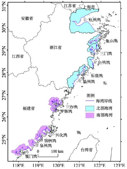

Jialin LI, Lijia WANG. Spatial and temporal evolutions of the major bays in the East China Sea under the influence of reclamation [J]. Acta Geographica Sinica, 2020, 75(1): 126
- Acta Geographica Sinica
- Vol. 75, Issue 1, 126 (2020)
Abstract


Set citation alerts for the article
Please enter your email address

© Copyright 2018-2021 | Chinese Laser Press. All Rights Reserved 沪ICP备15018463号-20